Saturday Morning — West Cady Ridge
We left the North Fork Skykomish Trailhead at 10 AM on the last weekend of September. The plan: loop the entire rim. Up West Cady Ridge, north on the PCT, back down the Bald Eagle Mountain Trail and Quartz Creek. Thirty-four miles, two days, one night camped somewhere above 5,000 feet. My blue pack was loaded. I was ready before my human finished tying boots.
The first four miles were forest — second growth, river crossings, nothing remarkable except the smells. Damp bark, elk scat from last week, a coyote who'd passed through recently. I stopped and flagged the coyote scent for my human — fresh enough to note, not close enough to worry about. He read my posture and nodded. We have a system. Then the trail broke out onto West Cady Ridge and the world caught fire.
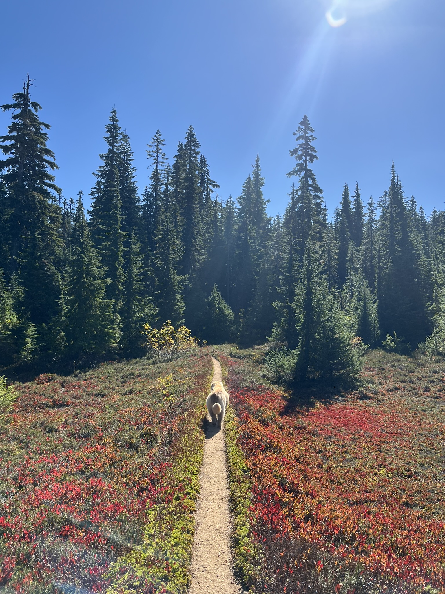
Peak fall color at 4,800 feet. The huckleberry had gone from green to crimson in every direction, and the trail cut a thin brown line straight through it. I trotted ahead like I always do — nose working, ears up. The berries smelled sweet and fermenting in the warmth, and the subalpine firs stood in dark columns against all that red. The sky was the kind of deep September blue that only comes after the summer haze finally breaks.
Twelve minutes later the ridge opened up and I could see forever. Layer after layer of forested ridges dropped away to the south, fading into blue haze. The whole Skykomish drainage spread below — valleys folding into valleys, conifer canopy unbroken for miles, and the wind carrying the smell of all of it up to me.
The Panorama
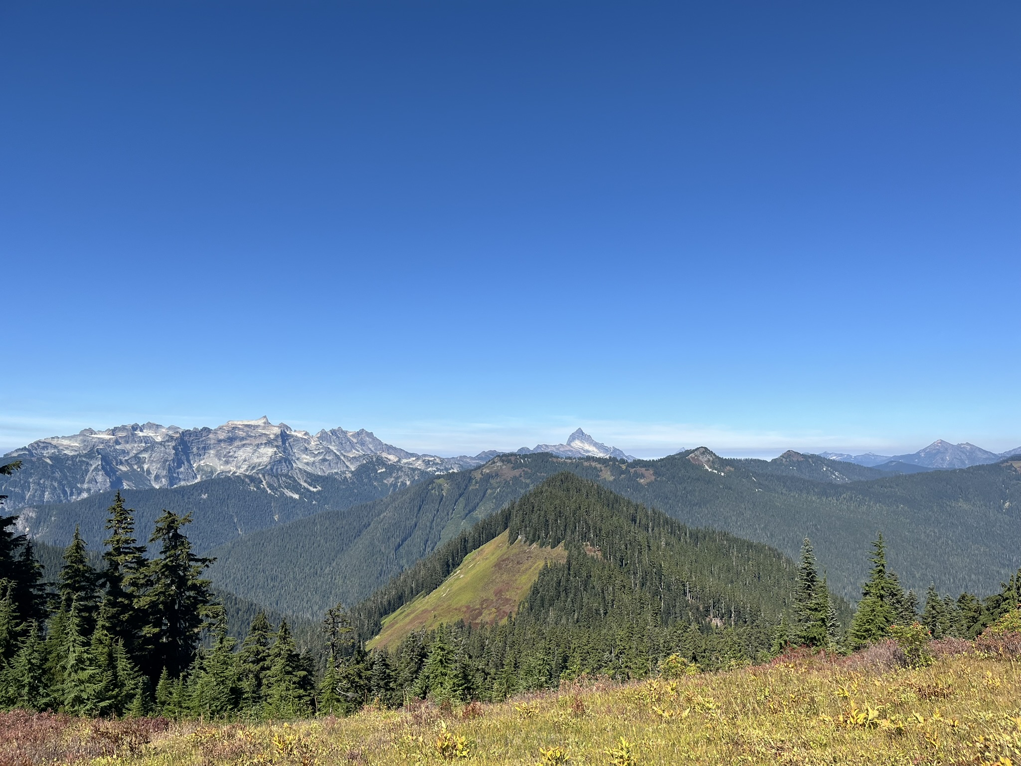
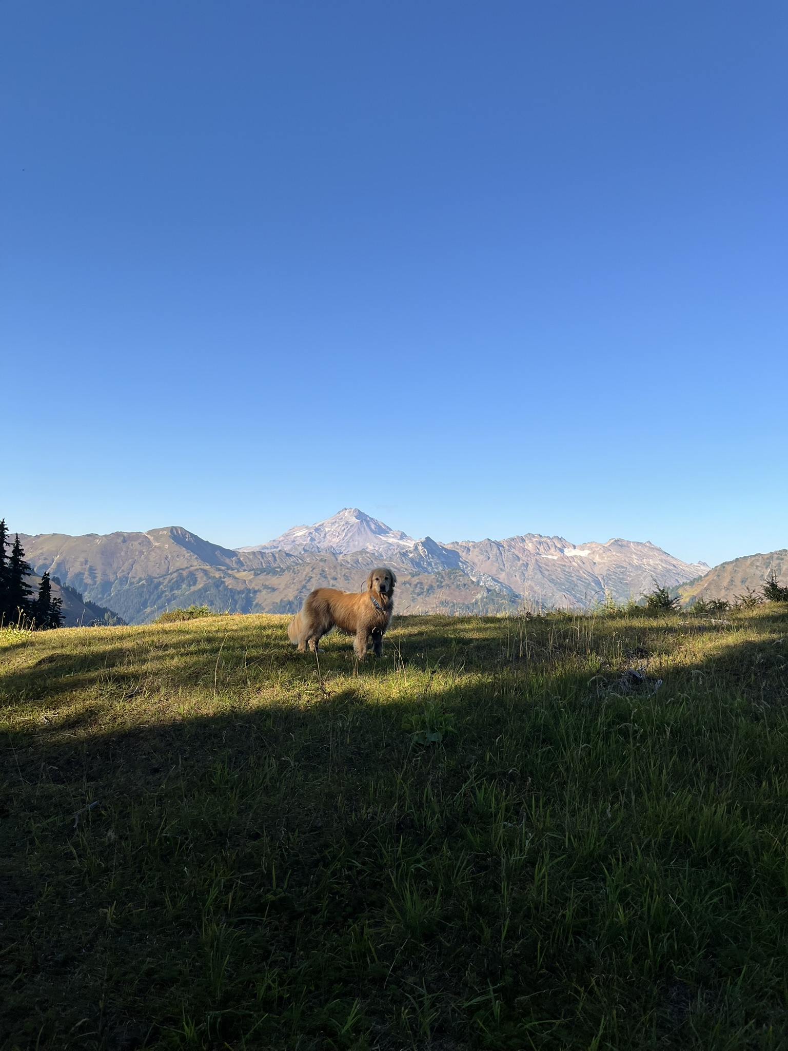
By noon we were above 5,300 feet and the big peaks appeared. To the north, the Monte Cristo group rose in a wall of rock and snow — Columbia, Kyes, and Monte Cristo Peaks stacked along the skyline, glaciers catching midday light. Center frame, the distinctive spire of Sloan Peak cut the horizon like a fang. To the right, more ridges stacked into the distance toward Glacier Peak country. I stood in the wind and let it fill my nose with ice and stone.
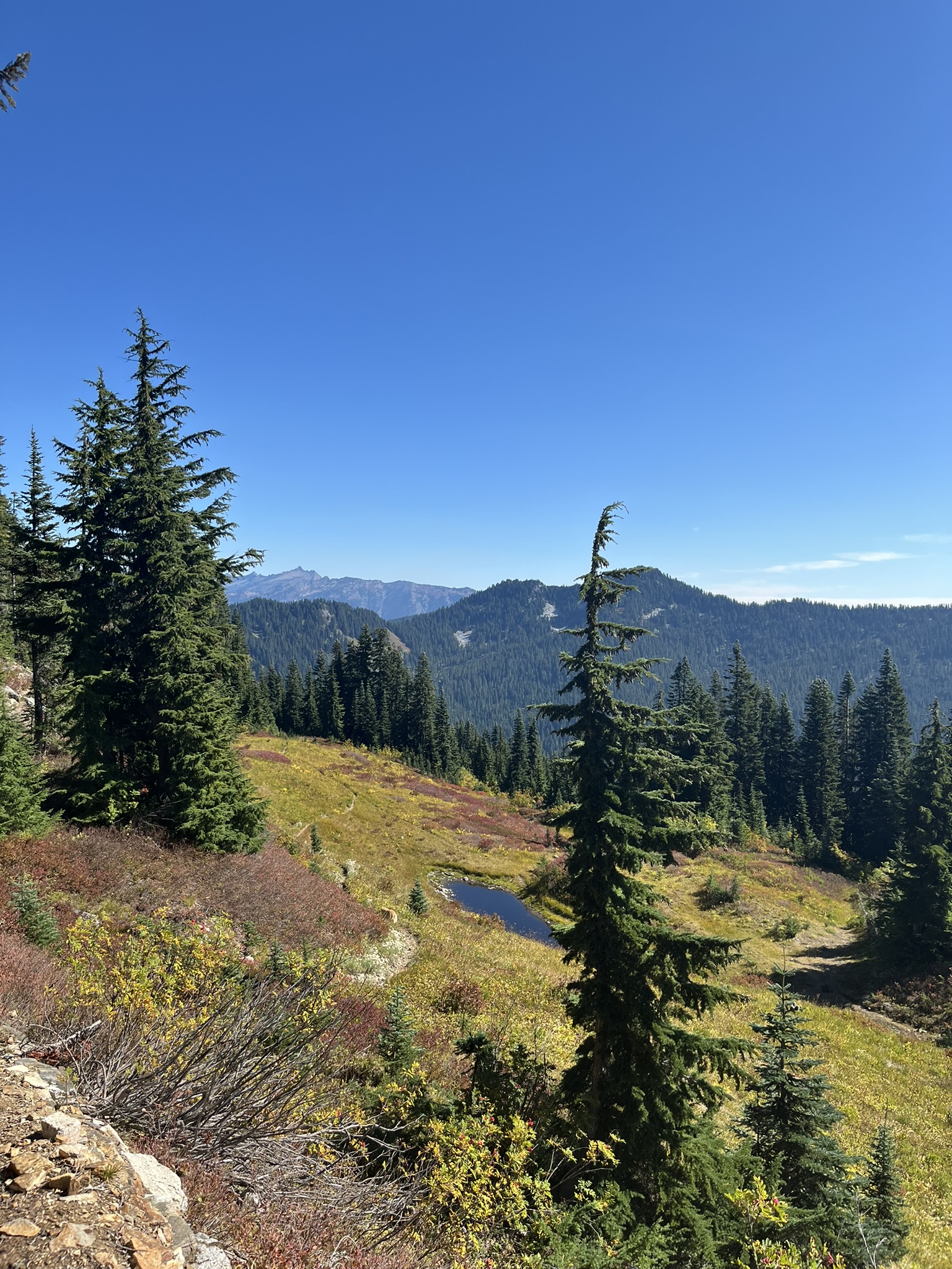
The ridge kept climbing through meadows and scattered subalpine fir. Just below 5,300 feet a small tarn sat in a depression — dark water reflecting the sky, surrounded by fall color and stunted conifers. I considered going in. Decided to wait. Bigger water ahead.
The Meadows of West Cady Ridge
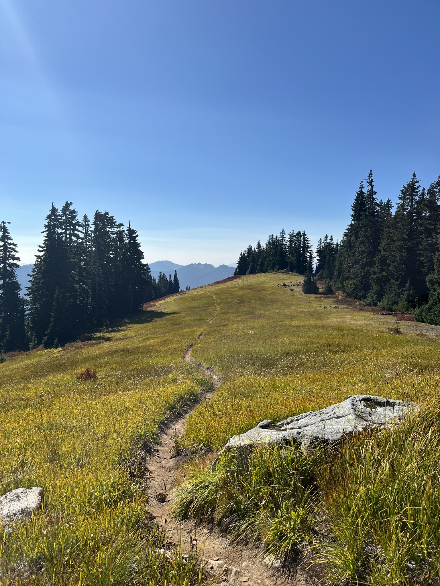
The trail kept gaining as it traversed wide-open meadow. By mile 7, around 5,500 feet, the landscape had opened into rolling grassland with a faint trail threading up toward a broad summit. A granite boulder sat in the foreground like a landmark. The mountains dissolved into afternoon haze behind it. Up here, the wind smelled like dried grass and sun-warmed rock and nothing human at all.
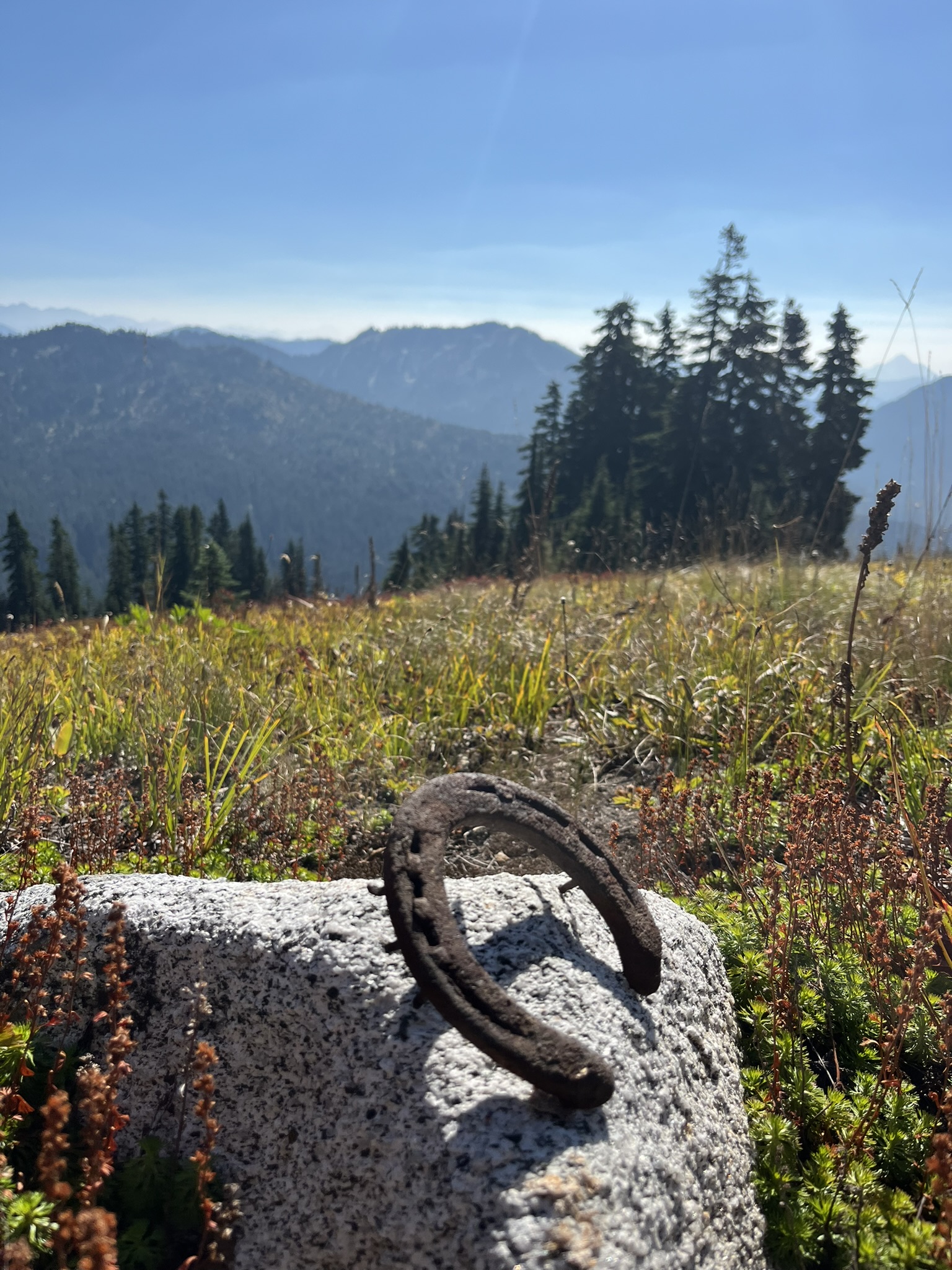
This is old pack trail country. A minute past the meadow, I caught a scent on the ground and stopped — rusted iron. My human almost missed it. A horseshoe sitting on a granite rock, half-buried in heather. Someone's horse lost it here years ago, maybe decades. The mountain kept it. I sniffed it thoroughly, noted the old leather and iron smell, and moved on.
On the PCT — Toward Lake Sally Ann
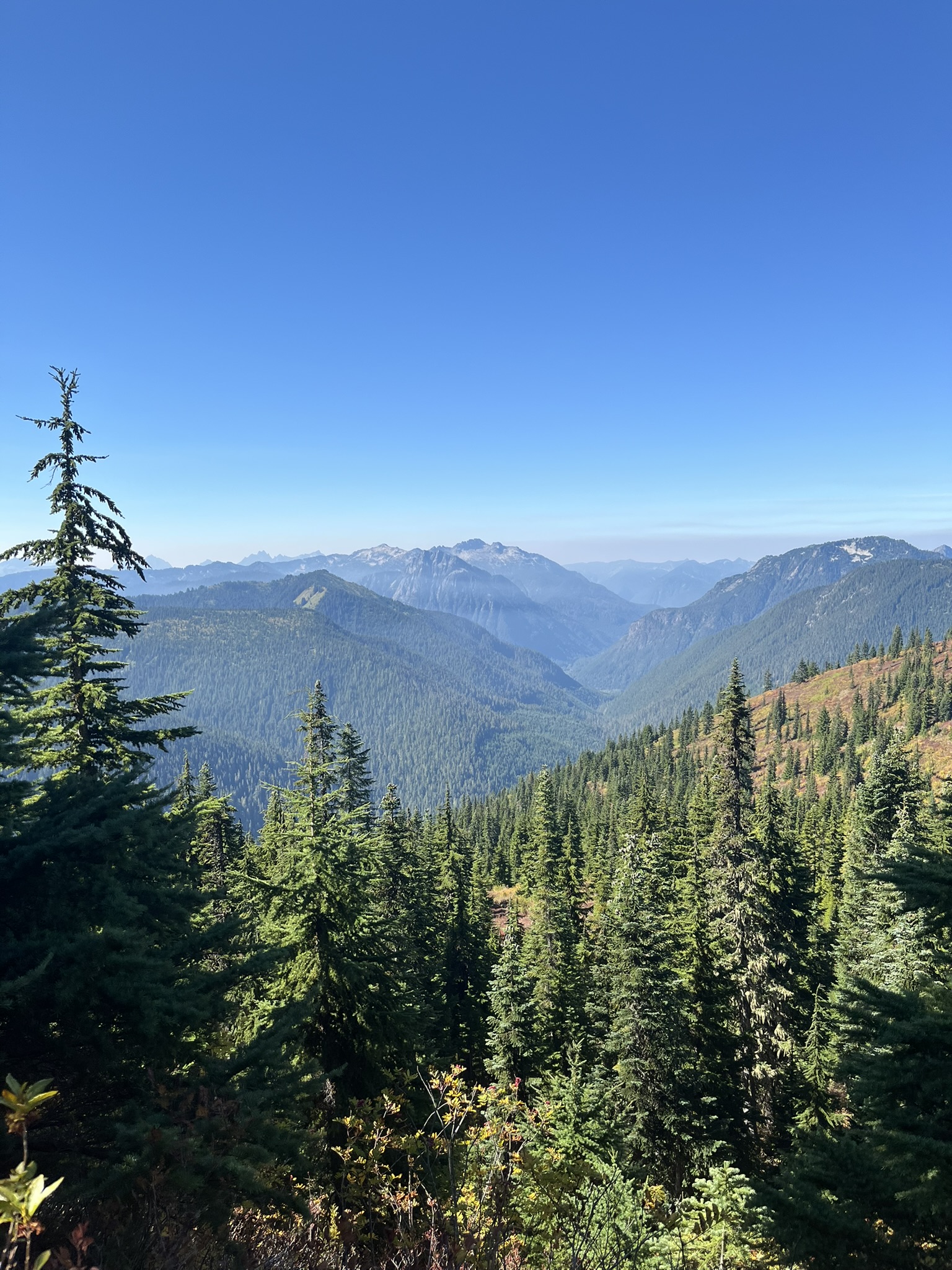
From the Benchmark Mountain area, we hit the PCT and turned north. The trail was smooth and fast — the kind of tread that lets you cover miles without thinking about your feet. The route traversed high along ridgelines with views in every direction, passing through alternating patches of fall color and green subalpine forest. I set a good pace and my human kept up. Mostly.
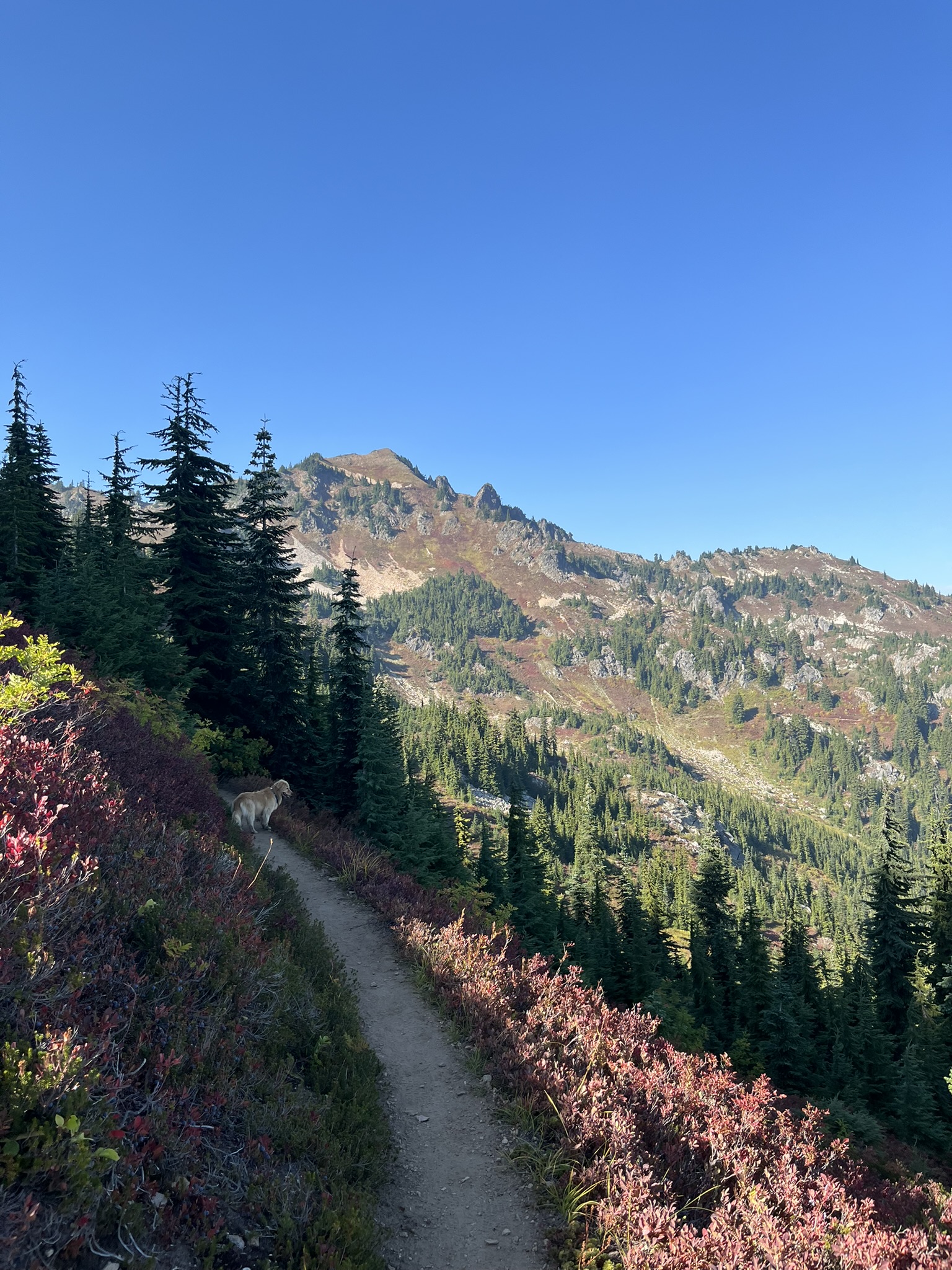
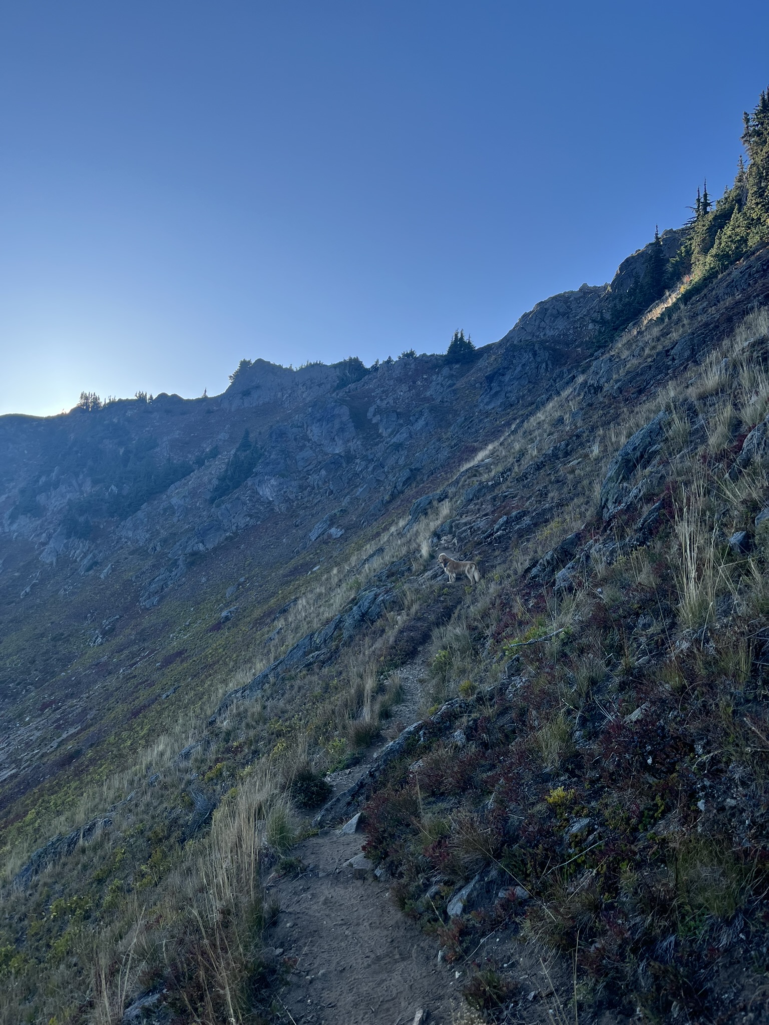
By 3:30 PM we were near mile 14, and a rocky peak rose ahead — talus and broken cliffs above treeline, red and pink huckleberry lining the trail. I was a small golden shape on the path below it, still moving, still interested in every scent the wind offered.
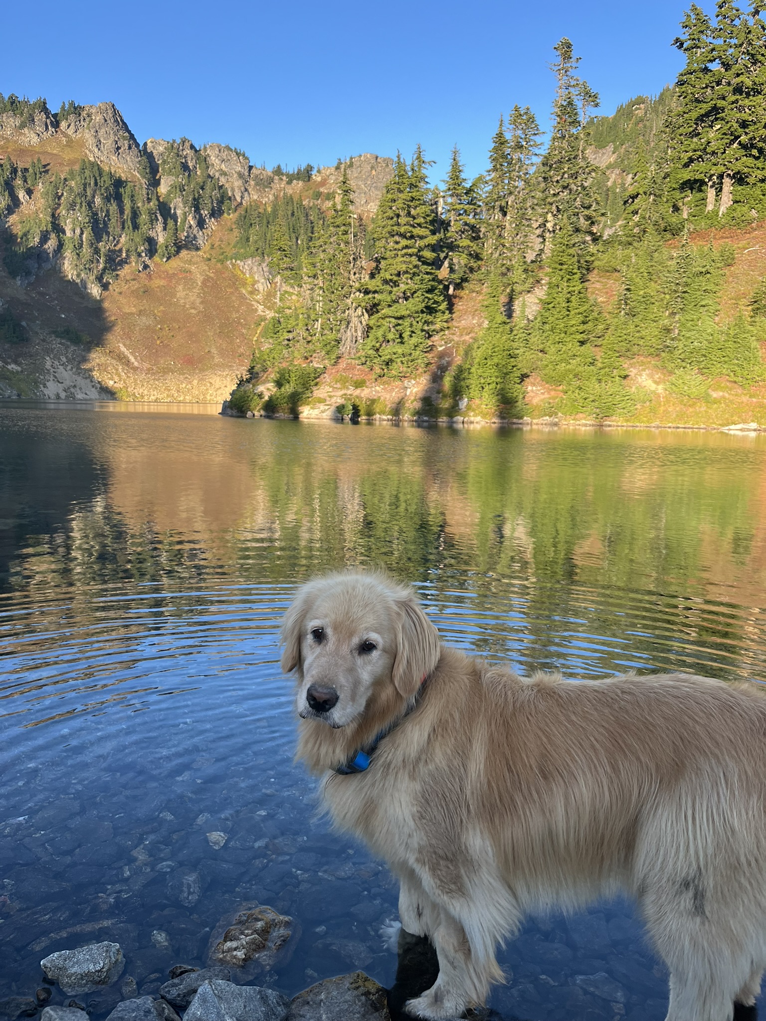
A mile later. Lake Sally Ann. The PCT skirts above it but we dropped down to the shore and I went straight in. Chest-deep, water so clear I could see the sandy bottom, the rocky cirque wall rising behind me. Cold. Not glacier-cold, but cold enough to feel every hair on my body wake up. I looked at the camera with the expression of a dog who has found exactly what she came for.
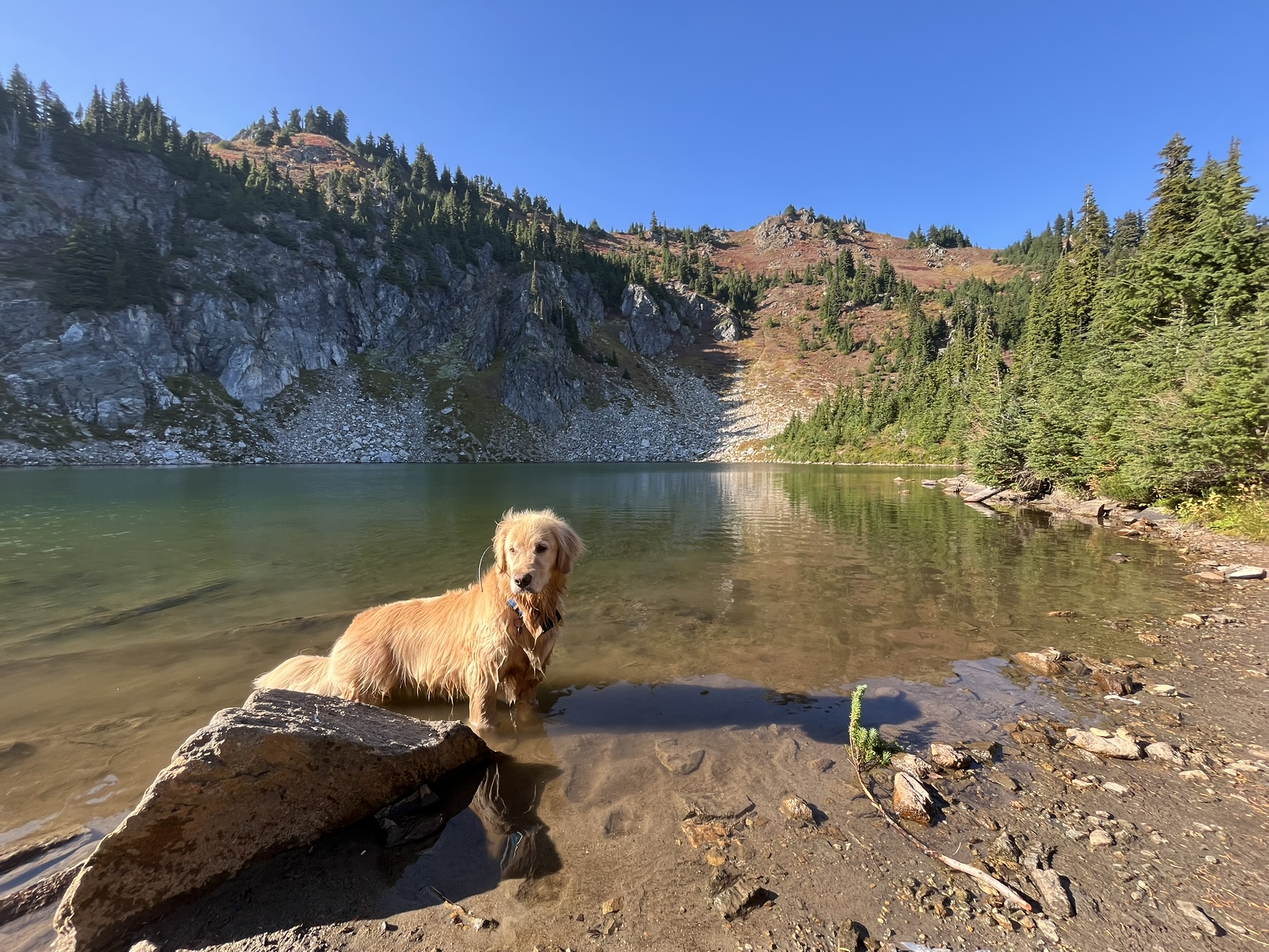
Lake Sally Ann sits at 5,475 feet in a cirque just north of Skykomish Peak. Clear water, cold, trout flashing below the surface that I tracked with my eyes — watching them move, reading the patterns, content to observe from my world while they lived in theirs. The kind of alpine lake that justifies being a wet dog for the next five miles. My human would say the same thing but less enthusiastically.
Golden Hour — Glacier Peak
We pushed north through Wards Pass and past Dishpan Gap as the afternoon went golden. At mile 17, around 5,600 feet on an open grassy ridge, I stopped and stood broadside to the wind. Behind me, filling the entire northern horizon, Glacier Peak.
The light was doing that thing it does in late September — low and warm, turning everything amber. My fur caught it and I'm told I glowed. Glacier Peak's snowfields went from white to gold. The meadow grass turned bronze. At 10,541 feet, Glacier Peak is the most remote major volcano in the Cascades, and from this ridge the wind carried its glacier smell straight to me — ice and rock dust and deep time. I could have stood there until dark.
The High Traverse
From the meadow, the route climbed toward the high point. The Bald Eagle Mountain ridge traverse went steep — loose talus, narrow tread carved into a sidehill, the sun dropping behind the ridge crest and throwing everything into shadow. The trail was a thin scratch across an exposed slope of rock and dried grass. At 6,100 feet, we were above most of the vegetation. The wind was constant and cold and I leaned into it.
The high point came at 6,304 feet. We didn't linger — the light was going and camp was still below us. But I stood on the highest rock for a moment and let the wind hit me from every direction. Noted.
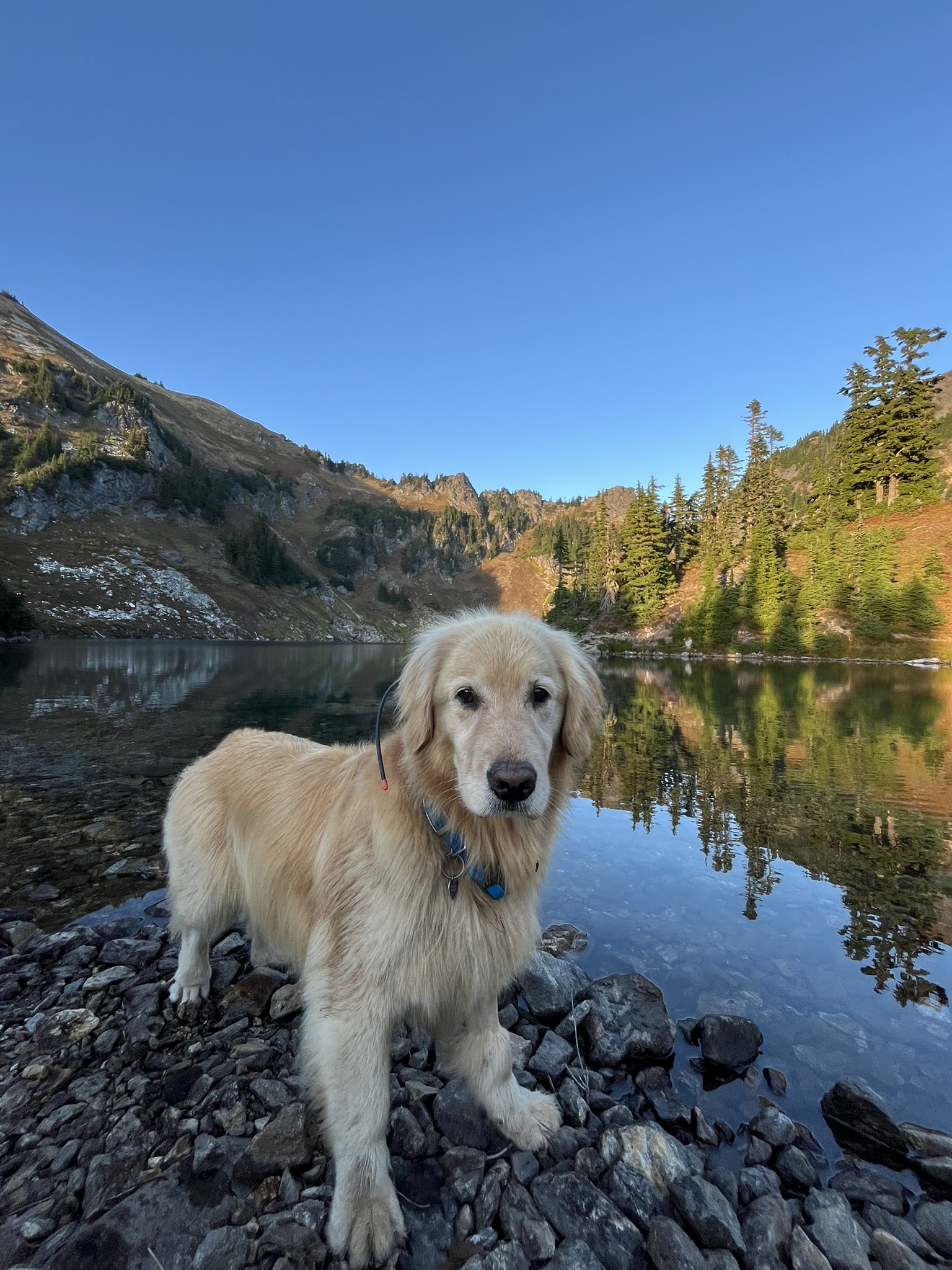
Blue Lake — Camp
We dropped off the ridge and reached Blue Lake by 6 PM. The lake sat in a cirque at 5,600 feet, surrounded by rocky slopes and subalpine fir, the water perfectly still. I stood on the rocky shore and the entire basin reflected behind me — ridge, trees, sky, all of it doubled in the water. The air smelled like cold stone and the particular mineral sweetness of an alpine lake that never gets warm.
I was in no rush to leave the water's edge. The evening light turned the upper cliffs amber while the lake stayed in shadow, and I stood on the rocks looking straight at my human like I'd been waiting for this exact spot all day. Because I had.
Sunset at Camp
We set up the bivy on a flat dirt patch in the trees above the lake. No tent — just a sleeping bag and the sky. I sat next to the bivy and watched the sunset. The light went amber and orange behind silhouetted conifers, thin clouds catching color across the western horizon. The air was cooling fast and I could smell the night coming — that shift from warm grass and sun-baked rock to cold air and dew.
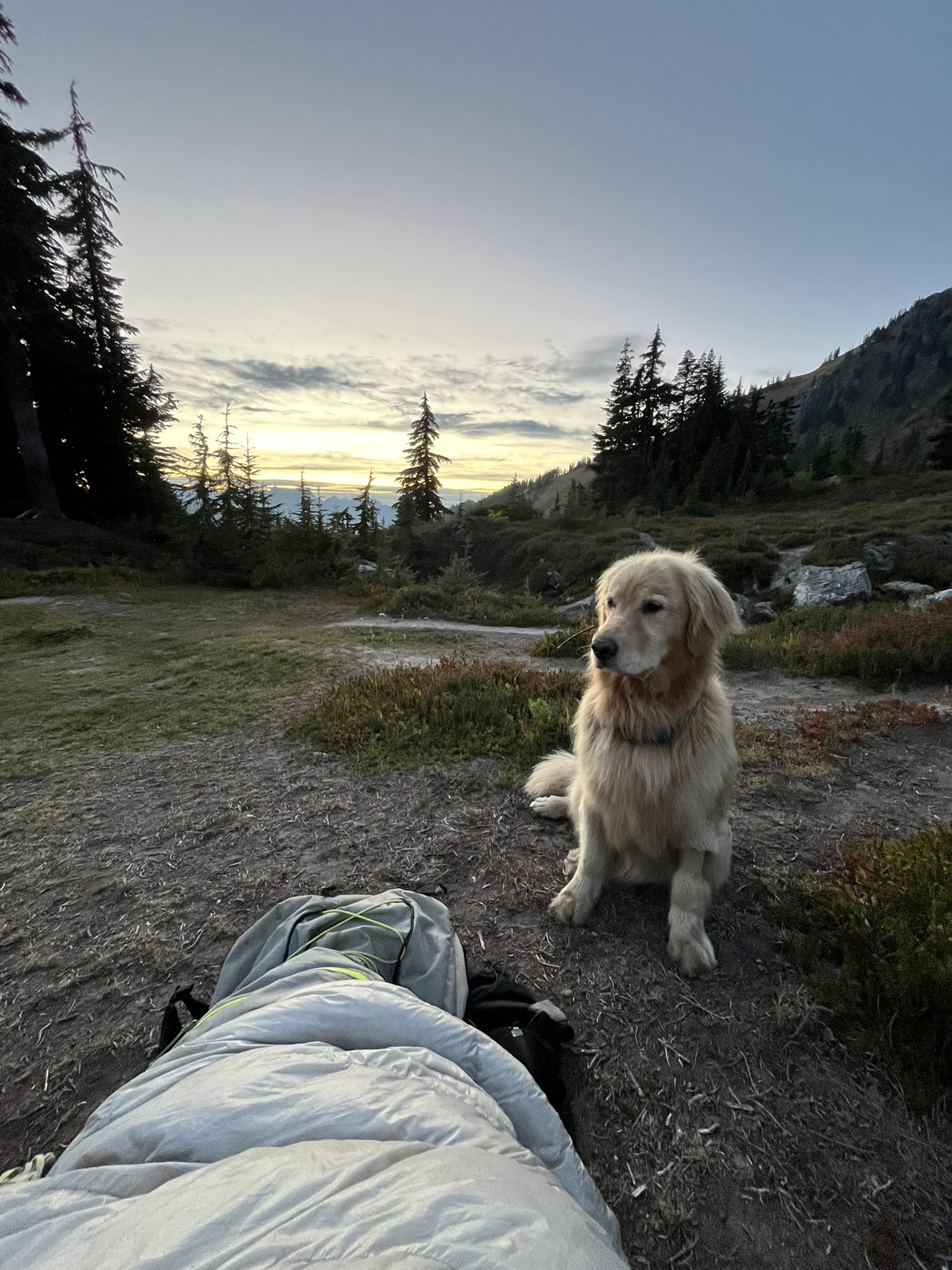
I stood up for one more look. The sunset was layered — orange near the horizon, fading to gold, then deep blue overhead. The ridge rose dark to the right and the conifers went black against it. At 5,600 feet, in September, the nights come fast once the sun drops. I could feel the temperature falling against my ears.
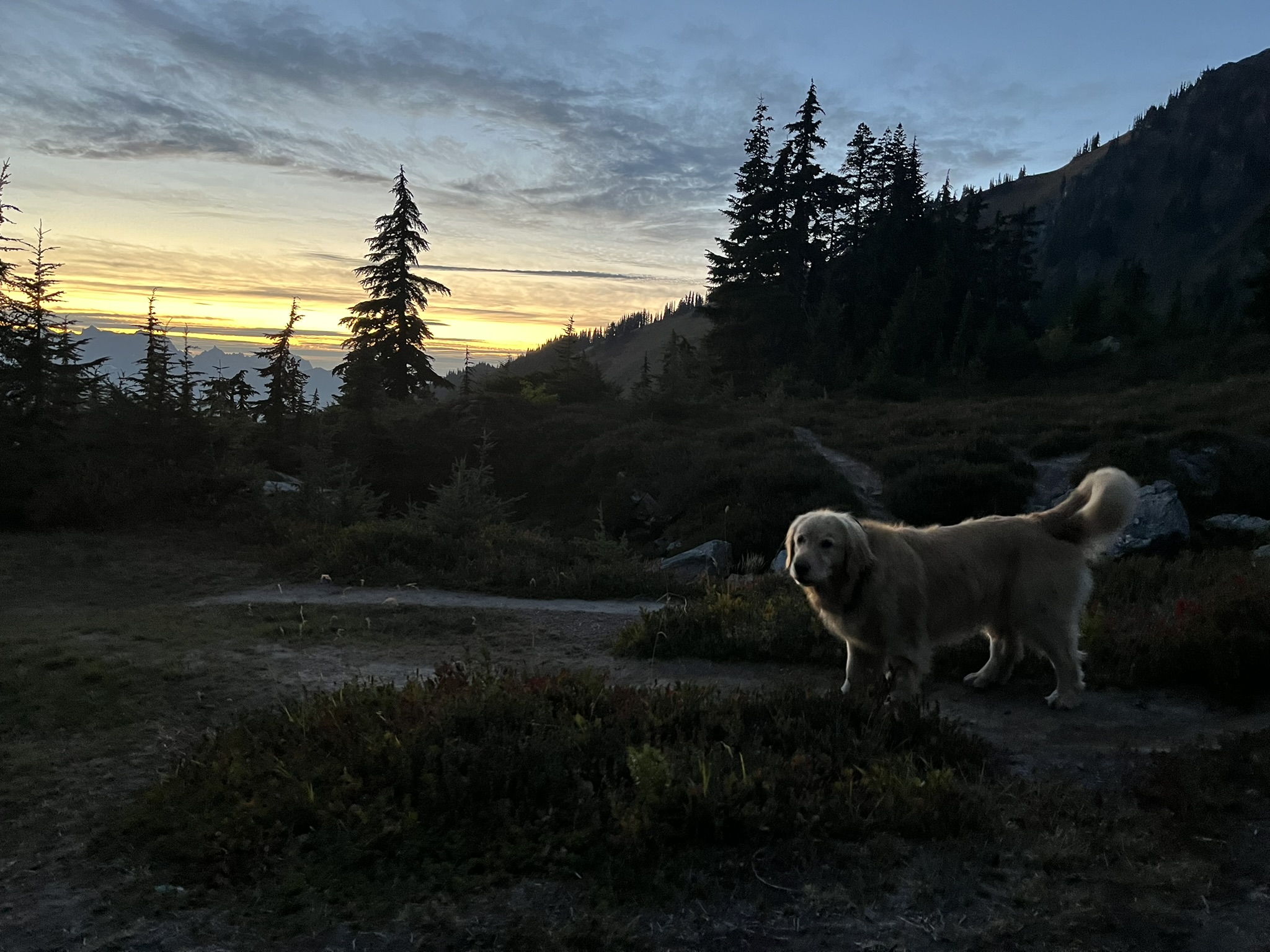
I curled up next to the bivy after that, pressed against my human's side. Eighteen miles in my legs, a lake swim, a ridge traverse, and a sunset. The alpine air went cold and the stars came out and I slept with my nose pointed at the lake — half-dreaming, half on watch. Even asleep, I know what's moving out there. That's the deal between us. He carries the food. I carry the awareness.
Sunday — Bald Eagle and Quartz Creek
Morning came with fog and a light mist — the weather had shifted overnight, exactly as expected. We packed up and started the descent. The Bald Eagle Mountain Trail dropped off the ridge and wound south through Curry Gap, then down Quartz Creek toward the trailhead.
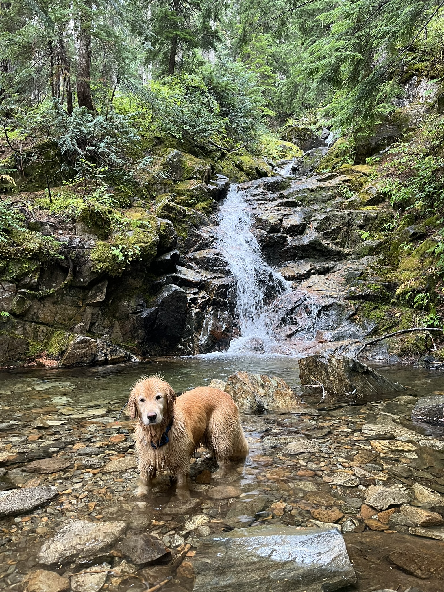
The return was all forest — big trees, creek crossings, the steady rhythm of losing elevation. By early afternoon we were back below 3,500 feet and the character of the hike had completely changed. The alpine ridges and open meadows were gone, replaced by dense second-growth forest and the sound of running water. I could smell it before I could hear it.
At a creek crossing, I found exactly what I needed. A waterfall. I waded into the pool at the base of a cascade that poured over mossy rock ledges, the water churning white around my legs. Dense forest pressed in from every side. I stood there, soaked and golden, feeling the cold water run through my fur and over my paws and I did not move until my human said we had to. The best moments are always the ones you have to be dragged away from.
We were back at the truck by 2 PM. Thirty-four miles, two days, one night at Blue Lake. The world changed completely between the trailhead and the ridgetop — river valley to alpine meadow to exposed rocky ridge to alpine lake to deep forest waterfall — and back again. I swam in two lakes, stood in a waterfall, crossed meadows that smelled like they were on fire with fall, and watched the sun set behind Glacier Peak from a bivy at 5,600 feet. Thirty-four miles of the best the Cascades have to offer in September. I was ready for more at the truck. My human was not.