Into the Clouds
Tuesday evening. Late July. We started up McClellan Butte around 5 PM — the kind of day where the I-90 corridor sits under a low gray lid and everything above 4,000 feet simply ceases to exist. No one else at the trailhead. Sixty-seven degrees and the air so thick with moisture I could taste it. Good. I prefer it this way. Heat is the enemy.
The first mile follows an old logging road through second-growth forest. I trotted ahead, nose down, cataloguing: damp earth, rotting cedar, something small that had crossed the road recently — a vole, maybe. I noted it and moved on. I don't chase. I just like knowing who else uses this road. The trail proper begins where the road ends, switchbacking up through big timber — Douglas fir, western red cedar, the understory thick with salal and sword fern. The smells layered and deepened as we climbed. Above us, nothing but cloud.
By the time we hit the boulder field around 3,500 feet, the fog had swallowed everything. Trees thinned and the world shrank to fifty feet. Wet rock, dripping moss, the sound of my own breathing and my paws on stone. No photos on the approach — my human needed both hands, and the fog wasn't giving us anything to look at anyway. I didn't mind. My nose was plenty busy.
The Summit
The scramble starts where the maintained trail quits, about a quarter mile below the top. Wet Class 3 rock in fog — every hold tested before committing. I picked my way up the exposed slabs without hesitating, finding routes through the rock that my human had to follow. I'm better at this than anyone wants to admit.
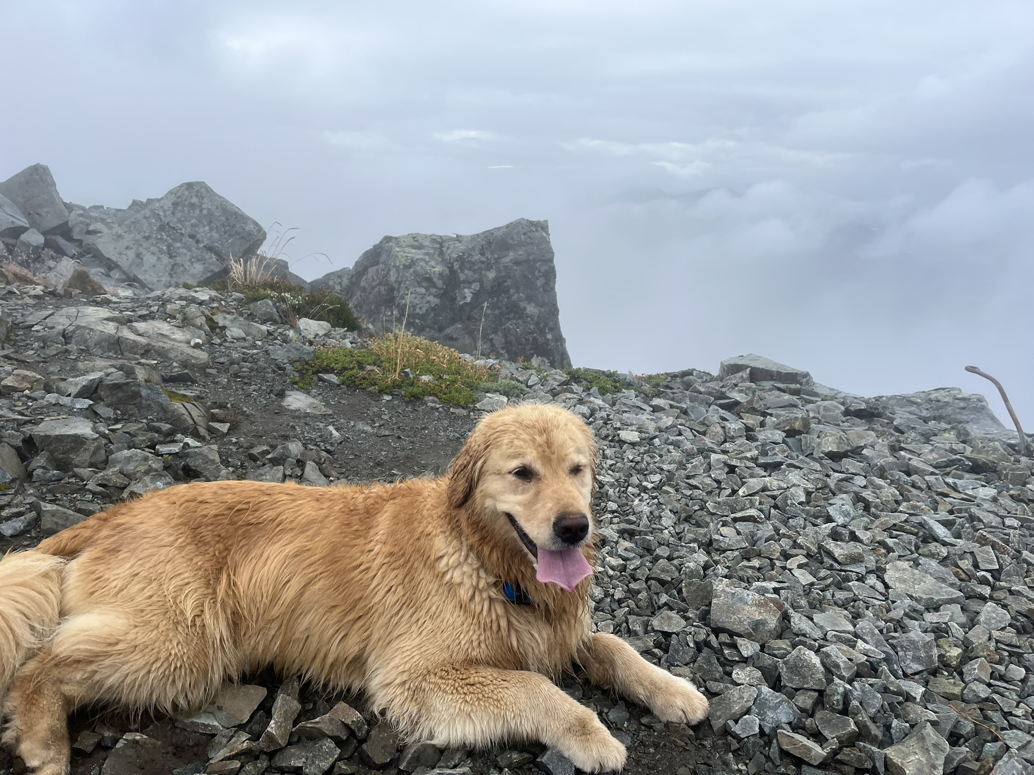
We topped out at 5,157 feet just before 7 PM. The summit of McClellan Butte is a narrow rocky point — talus, broken rock, a few stunted trees. On a clear day, apparently you can see Rainier, the Snoqualmie peaks, Chair Peak, the whole I-90 corridor. Today there was nothing. Just gray in every direction, the rock wet and dark, the world ending ten feet past the edge. Honestly? I liked it. The fog smelled like wet stone and alpine fir and the particular blankness of being inside a cloud. Quiet. Private. Mine.
I found a flat spot on the talus and lay down next to my human. Tongue out. Completely at ease. Just the two of us inside a cloud. The rock pinnacle behind me disappeared into the fog like it went on forever.
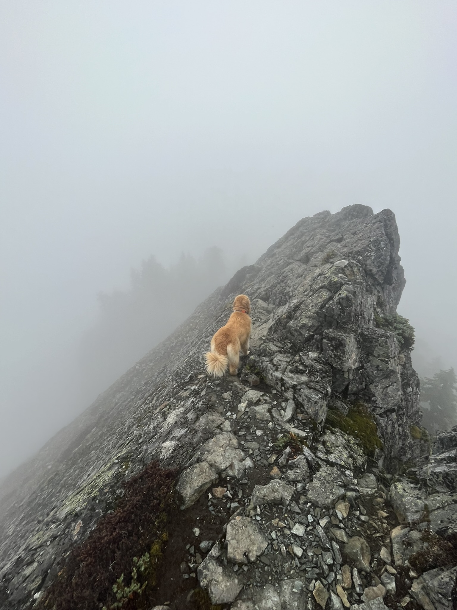
After a minute I got up and walked to the ridge edge. Looked out into the cloud. Nothing to see but I looked anyway. My coat was the only color up here — everything else was gray rock and white fog. The ridge dropped away steeply on both sides and I stood right on the line of it. The wind smelled like rain coming.
Turning Around
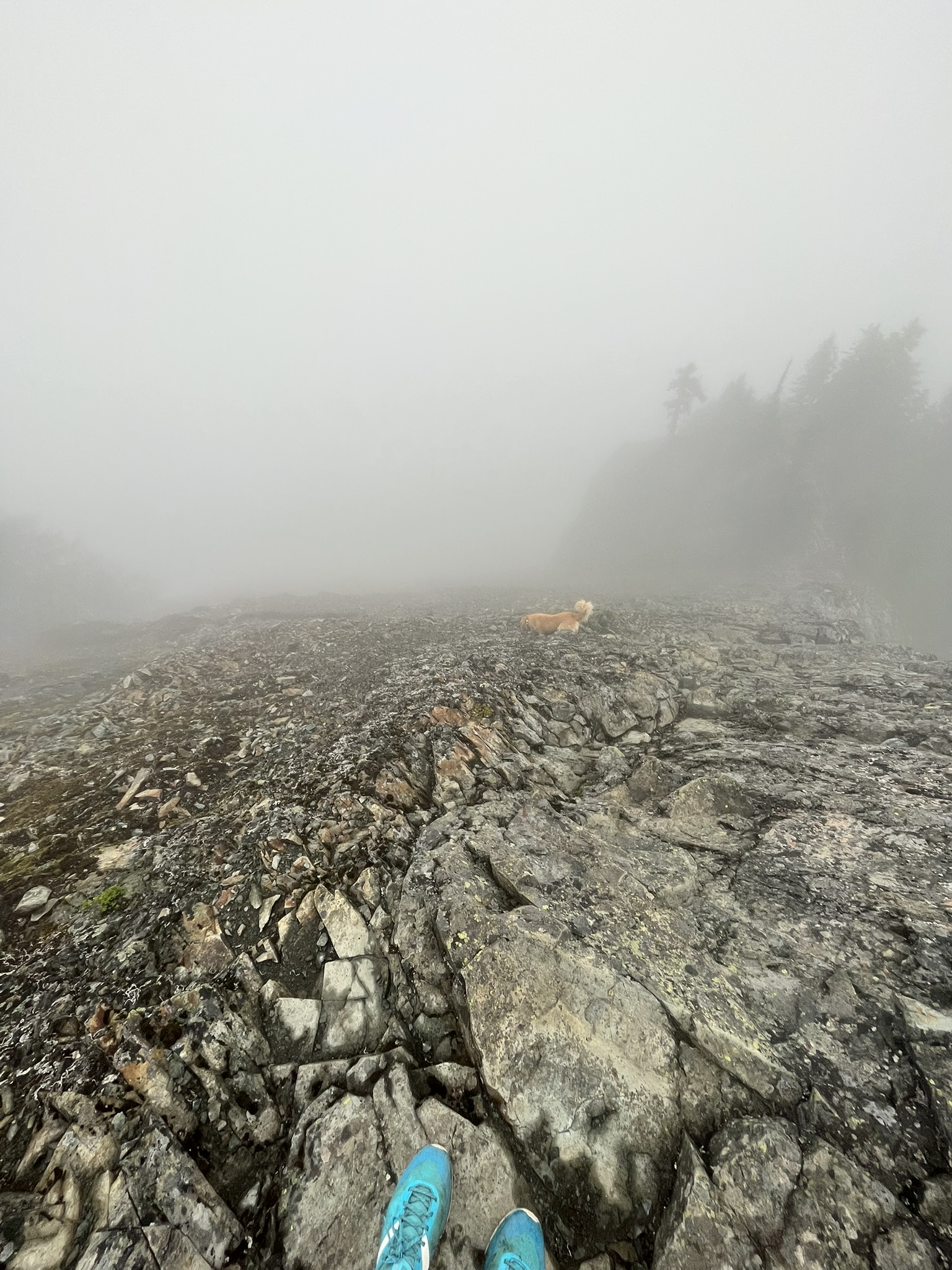
We spent about ten minutes on top. No reason to stay — nothing to see, and the wet rock wasn't improving. I started down the rocky slab below the summit, moving steady over the wet stone while ghostly tree silhouettes materialized and vanished in the fog. The rock was cold under my pads. I could feel every crystal in the granite.
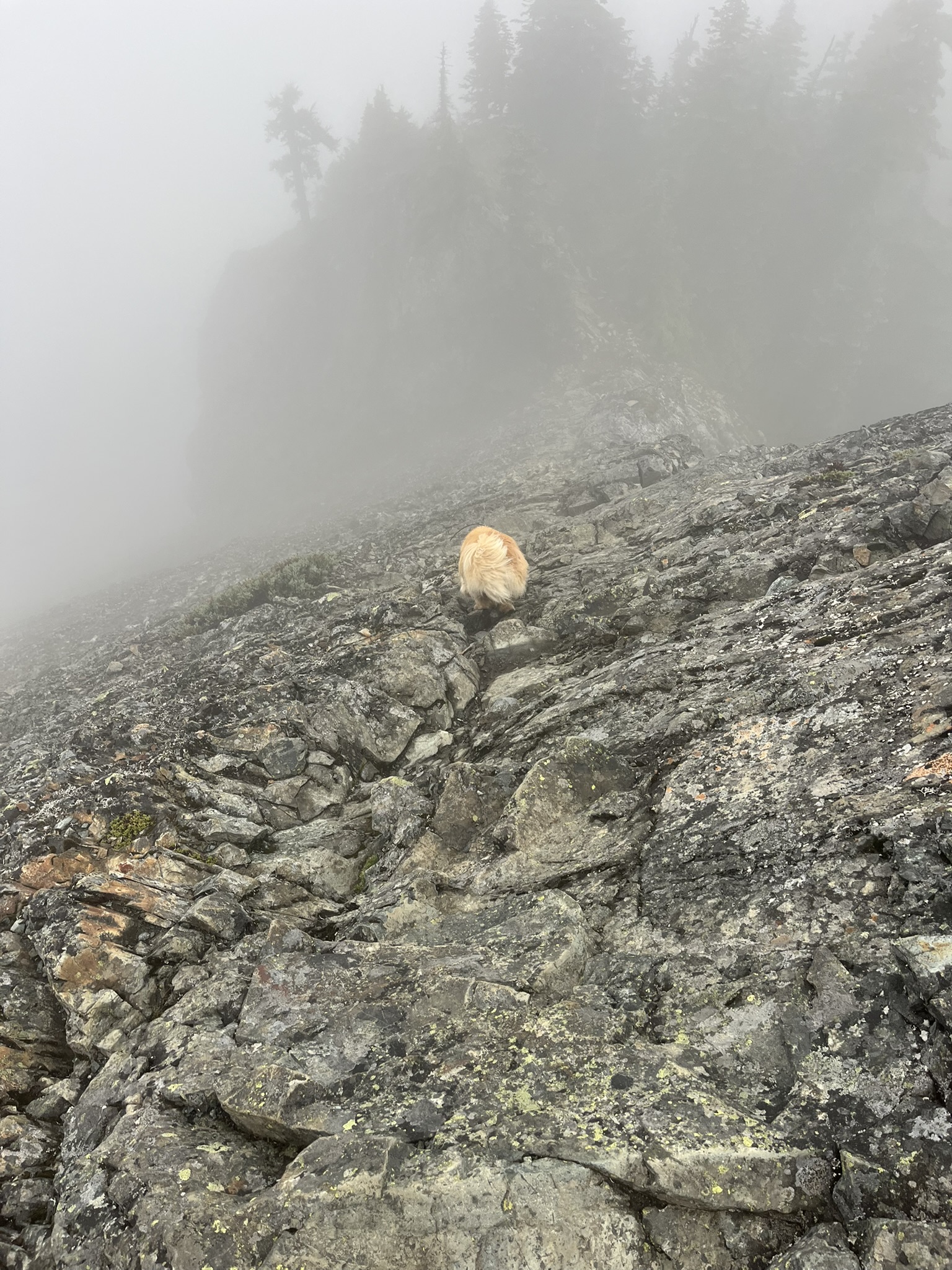
My human sat on the rock for a moment and watched me pick my way down. From up there I must have been just a small gold shape on a dark field of wet stone, the forest above dissolving into nothing. The kind of scene where you realize the mountain doesn't care if you can see it. It's still there. I could smell it even when I couldn't see it. That's enough.
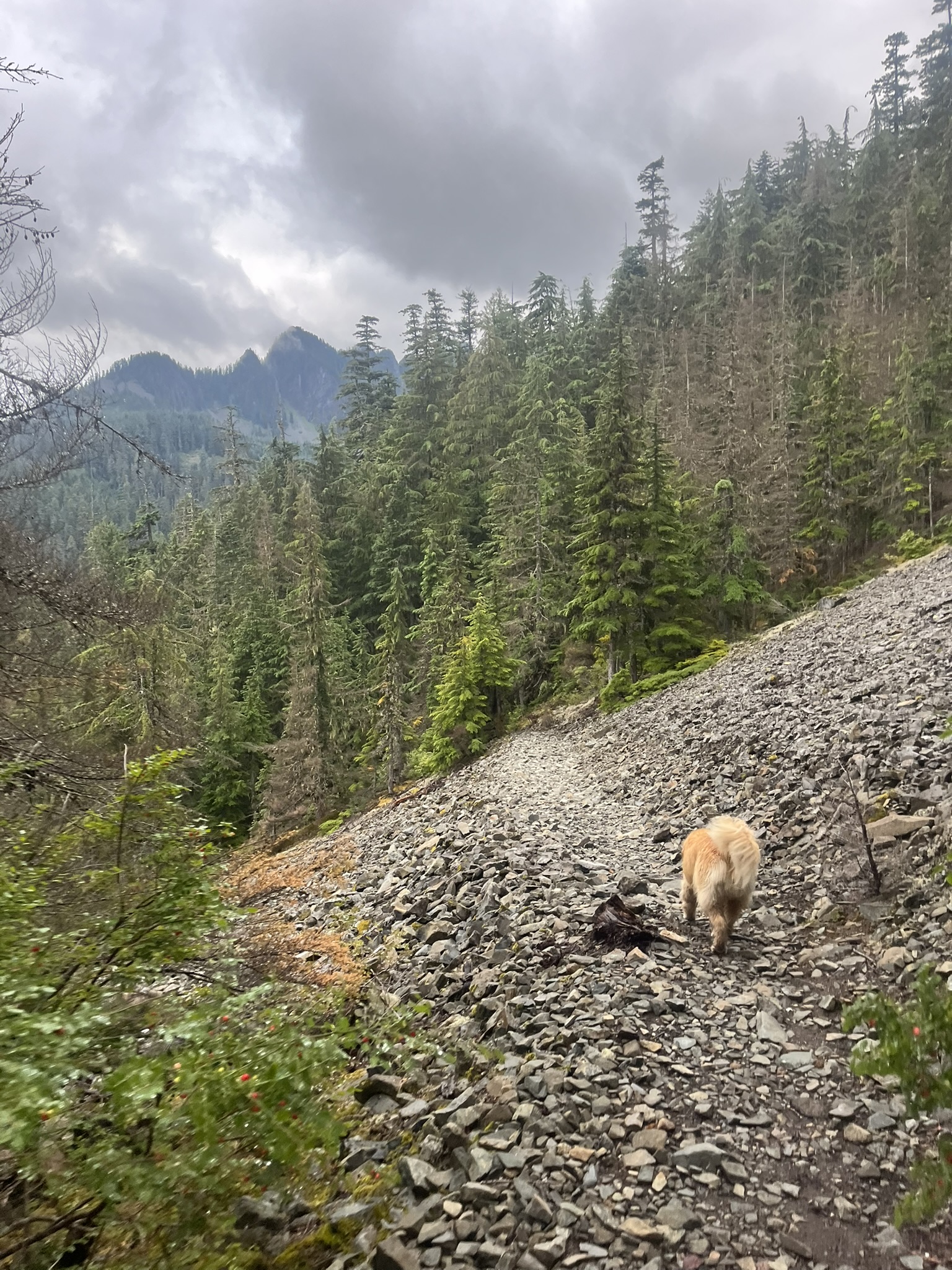
Below the Cloud Line
The descent went fast. We reversed the scramble, picked up the trail, dropped back into the trees. Somewhere around 3,000 feet the fog thinned, and by the mid-mountain switchbacks the clouds had pulled apart just enough to show peaks across the valley — dark ridgelines stacked against a gray sky. The views the summit had promised and the clouds had kept from us. I could smell the valley opening up before I could see it.
I moved steadily down the gravel trail, forest dense and green on both sides. Pacific silver fir and mountain hemlock crowding the slope, the air cooler and cleaner than it had been at the car. In the distance, through breaks in the canopy, jagged summits caught the last of the evening light. I felt it on my fur before I saw it — the first warmth of the day, filtering through the trees on the way out.
Back at the car by 8:15 PM. Three and a half hours, trailhead to trailhead. No views from the summit. No other people on the trail. No complaints. Some days the mountain gives you the postcard. Some days it gives you the fog, the wet rock, and the sound of your own paws on stone. Both are good. I don't need to see a mountain to know it's there. And I don't need a reason to go up one. The going is the reason.