Friday Evening — Into the Fog
We left Obstruction Point at 6 PM on a Friday in early October. My human had the big pack. I had nothing but my collar and four good legs. The plan was the Grand Loop — 43-plus miles through the heart of Olympic National Park, four passes, three days. Most parties take five. Not us.
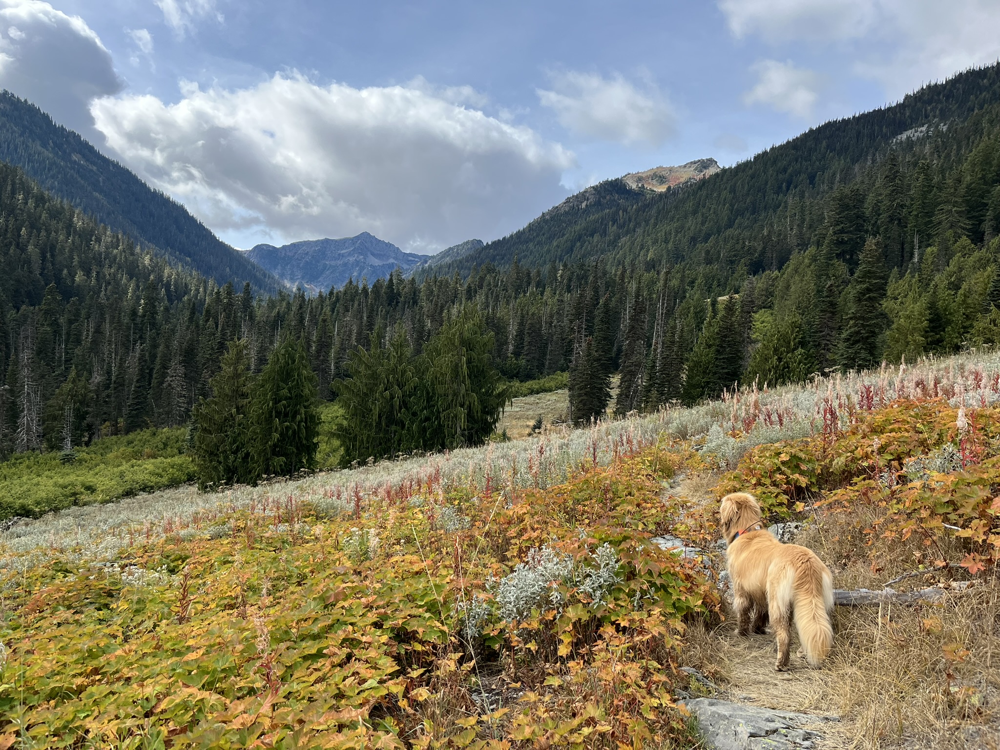
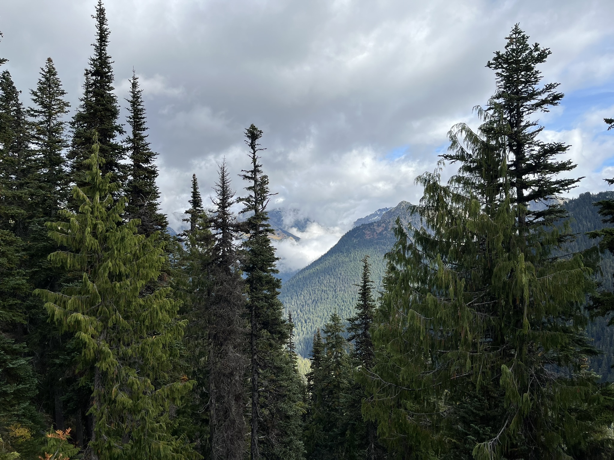
The evening was gray and cool, which suited me fine. I walked through dry alpine grass on the ridge, the subalpine firs behind me dissolving into cloud. The ground smelled like fall — cold dirt, dried seed heads, the last warmth leaving the soil. Everything golden brown at 5,000 feet.
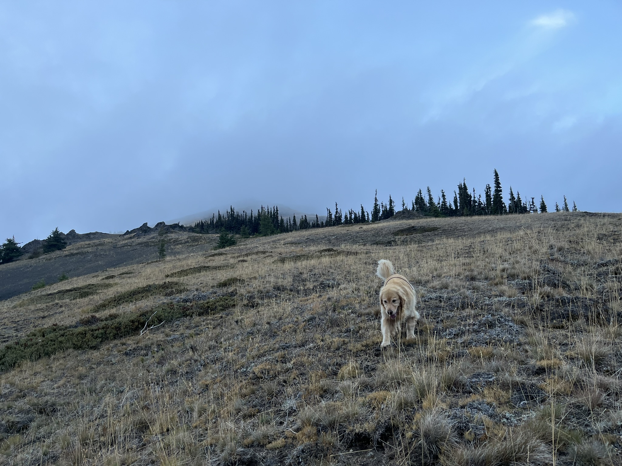
We pushed south along the ridge as the light died. Dropped below treeline, into forest, into darkness. Twelve miles in four hours with loaded packs. My human had headlamps. I had better night vision. We camped somewhere between Obstruction Point and Grand Pass, and I was asleep before the light clicked off.
Saturday Morning — Grand Pass
Morning came cloudy. I could smell the valley before I could see it — wet rock, distant snowmelt, something green and alive rising from below. We climbed south toward Grand Pass and the world opened up. A massive glacial basin dropped away to the east, a small tarn at the bottom, scattered trees clinging to the drainage like they weren't sure they belonged. Fall had turned everything yellow and gold. The clouds kept breaking and reforming around the peaks, dramatic and restless.
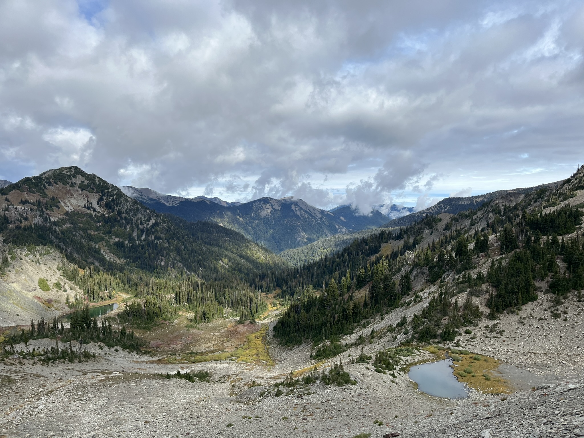
I stood on the ridge at Grand Pass and took it all in. Layer after layer of Olympic peaks receding into cloud, the ground dropping steeply on both sides, red and gold alpine scrub at my feet. First of four passes. 6,100 feet. The wind smelled like stone and distance.
I trotted across the open ridgeline, loose rock and dried grass under my paws, a steep rocky peak rising behind me. The scale of it — mountains in every direction, cloud moving through the gaps. I could have run this ridge all day.
The Descent — Down Into the Green
From Grand Pass we dropped. Hard. Over 2,000 feet of switchbacks, from barren scree into deep forest. By early afternoon I was walking through the Dosewallips drainage at 3,800 feet — a completely different world. The air was thick with plant smells, damp earth, decomposing leaves. Brush had turned red and orange, tall dead fireweed stalks lining the trail. Conifers rose steep on both sides. I caught the scent of elk somewhere off-trail — fresh, close, a whole herd bedded down in the brush. I stopped and turned my head toward the smell, ears forward, body still. My human read my posture and slowed. We passed through quietly. Their territory. We were just visitors.
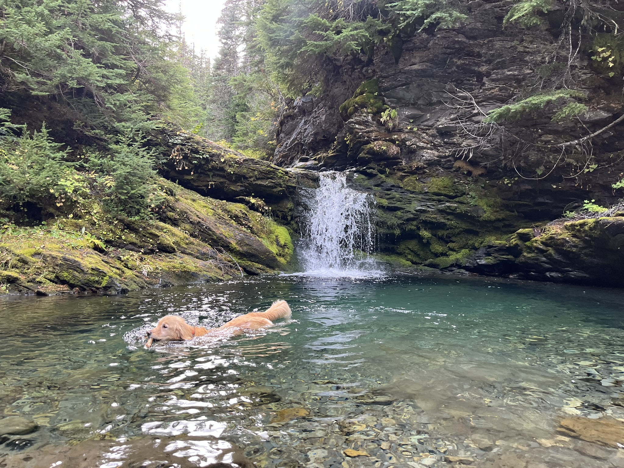
Cameron Creek — My Waterfall
The trail followed Cameron Creek west, climbing through old-growth forest. Then I found it. A waterfall poured over a rock shelf into a turquoise pool, framed by moss-covered boulders and dark conifers. I did not hesitate. I was in the water before my human could say anything, paddling through that clear blue-green, the waterfall cascading behind me, forest rising on every side. October in the Olympics. 52 degrees, maybe. Absolutely perfect.
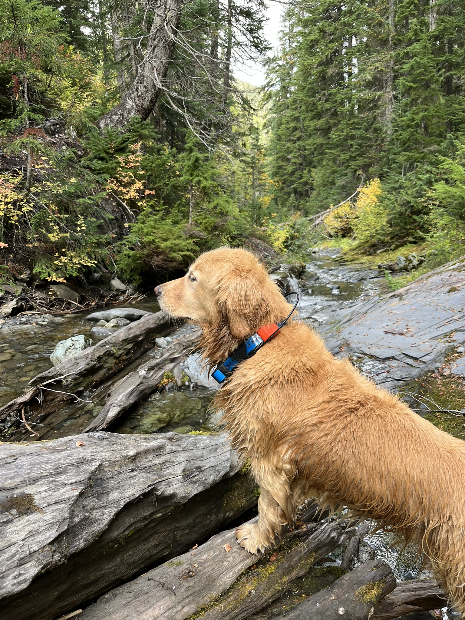
I climbed out onto the rocks and stood on layered slate above the creek, dripping and alert. My orange GPS collar and blue harness were the only color against all that gray stone and dark forest. The creek tumbled away downstream through a narrow channel it had cut into the rock. I shook once, thoroughly, and my human got wet. Obviously.
Climbing to Cameron Pass
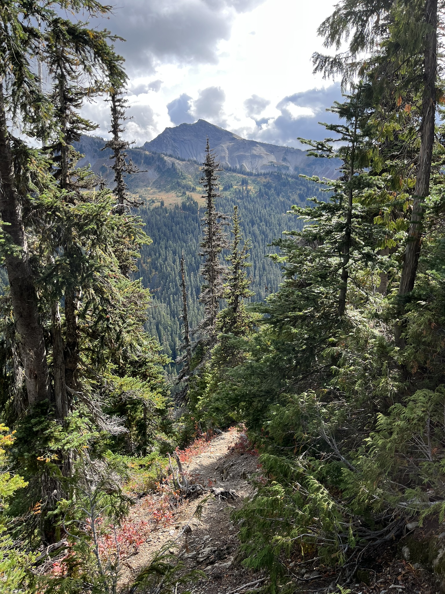
From Cameron Creek the trail climbed steeply back toward the ridgeline. Through gaps in the conifers I could see the peaks ahead — a prominent summit rising above the forest, the trail visible as a thin line cutting through brush and rock on the slope below. The smell changed as we gained elevation. Wet earth gave way to dry rock and alpine herbs.
Higher up, the trees thinned and the views opened east. A deep forested valley stretched away between ridges, clouds wrapping the peaks on the far side. I could feel the wind now, steady and cold, carrying the faint smoke-and-mineral scent of high places.
I sat in an alpine meadow at around 5,500 feet. A dramatic rocky peak rose directly behind me — steep scree and broken cliff bands leading to a craggy summit, dark clouds building overhead. The meadow grass had turned golden brown. My human said I looked small against the mountain. I looked exactly right.
The High Traverse — Cameron to Lost Pass
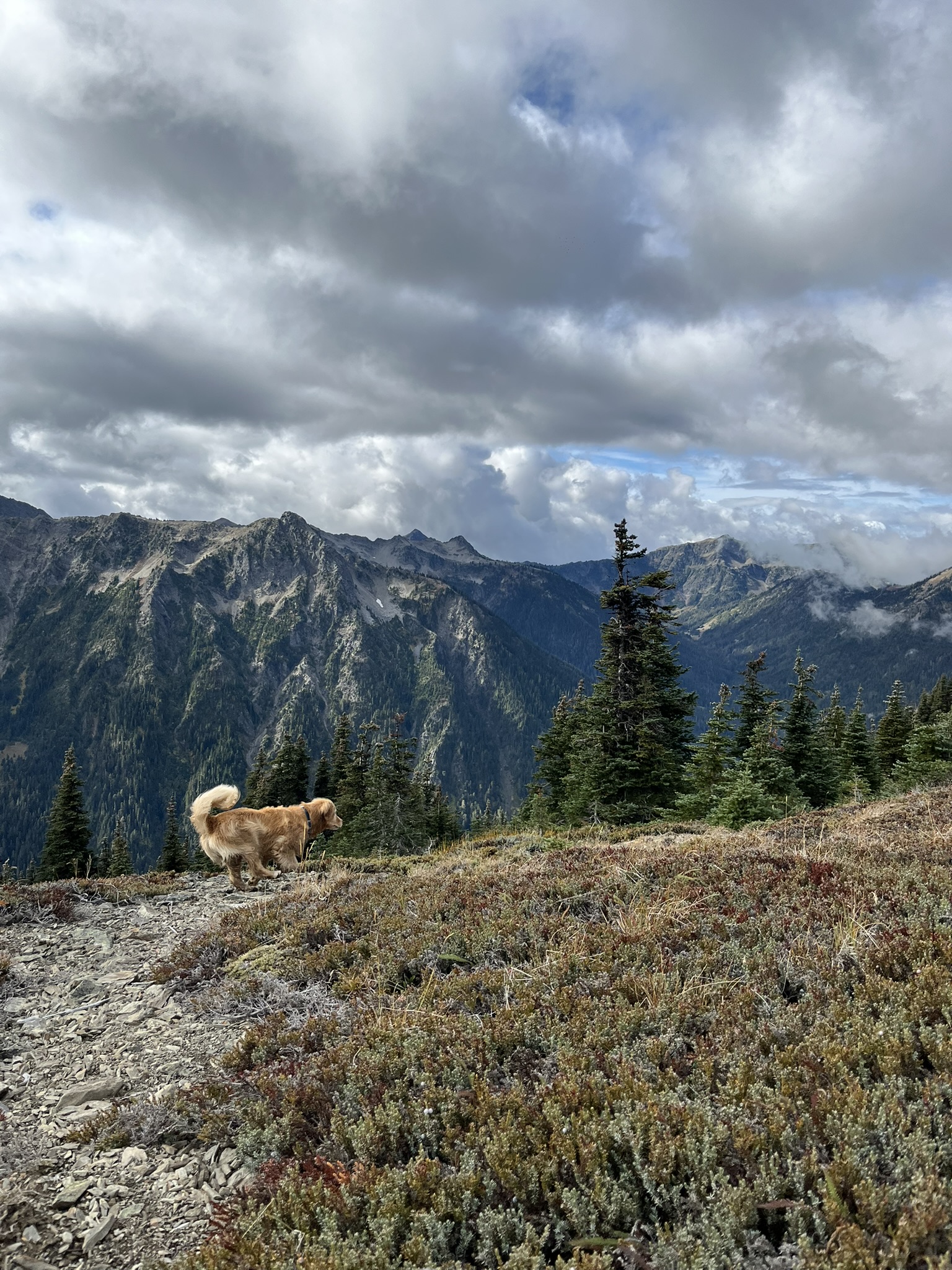
Above Cameron Pass the trail stayed high along the ridgeline, which is my favorite kind of trail. A sharp, pointed peak rose ahead — light rock streaked with red and orange mineral staining, patches of scree near the summit, subalpine trees at its base. The ground beneath me was a patchwork of gold and red fall color. This is where the Olympics stop looking like the Pacific Northwest and start looking like another planet. I approved.
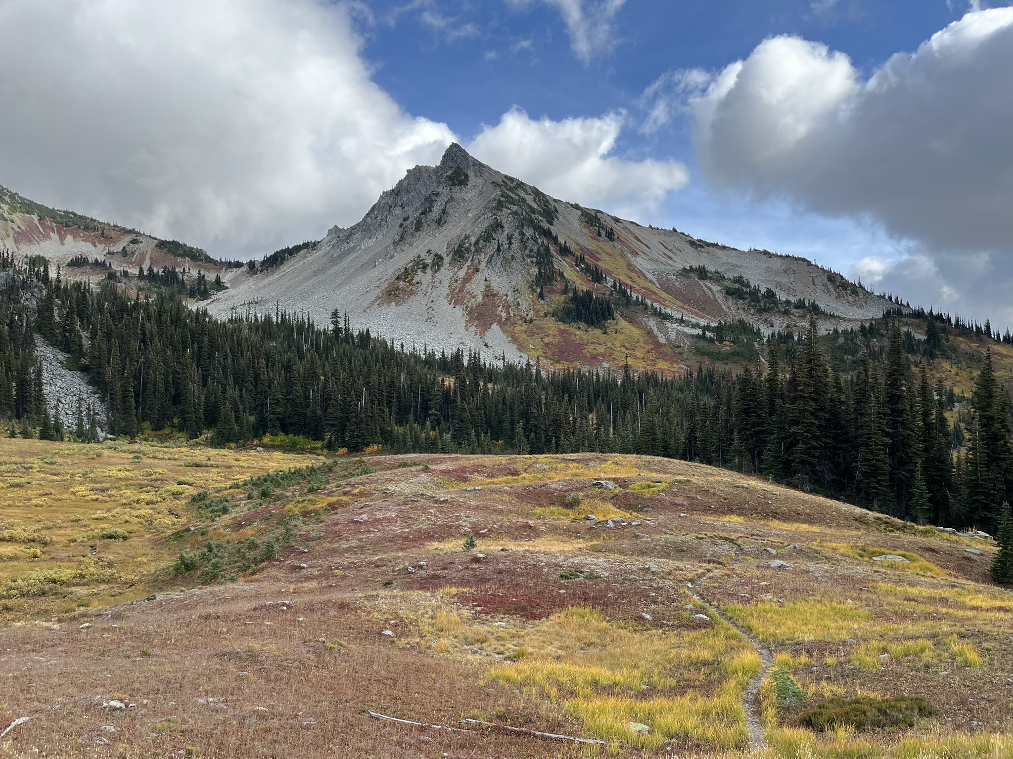
From 6,000 feet the view south opened into something that made me stop walking and just stand. Row after row of Olympic peaks, deep forested valleys between them, ridgelines tinged with fall color, clouds moving through the higher summits. A few lone trees marking where the alpine begins and the forest gives up. I sniffed the wind. Nothing but cold air and distance and stone.
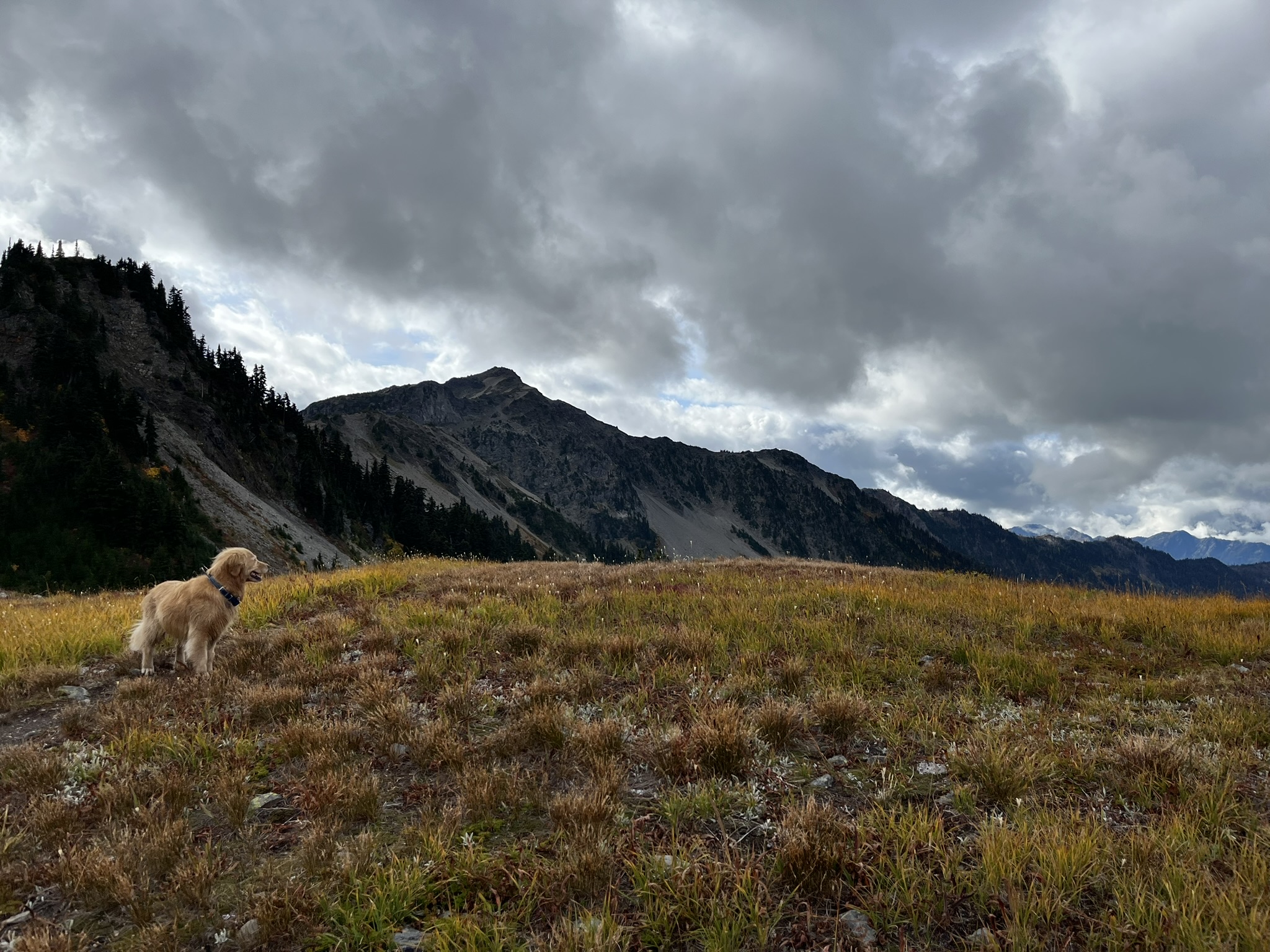
Lost Pass — Stone and Cloud
Lost Pass sits at the head of a barren scree basin at 6,200 feet. I liked it immediately. Everything stripped down to essentials — gray rock, loose gravel, scattered patches of yellow-green moss. Clouds poured over the ridgeline from the west, half-swallowing the slopes above. My golden fur was the only warm color in a world of stone and cloud. I could smell rain in those clouds, and minerals in the rock, and something ancient underneath it all.
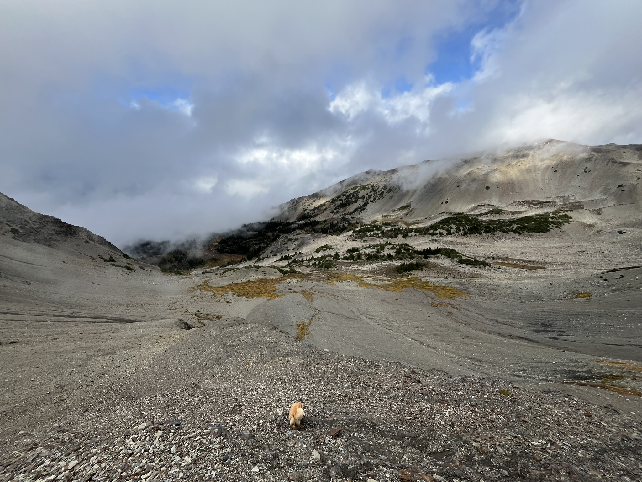
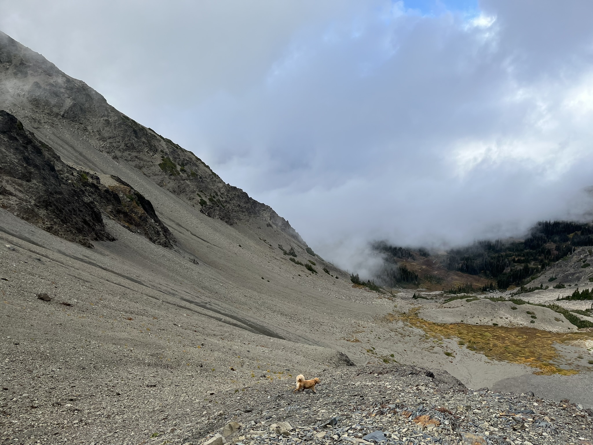
My human keeps saying the scale of this place is hard to convey. I am a full-sized golden retriever and I looked like a pebble in that basin. The mountains don't care how big you are. That's one of the things I like about them.
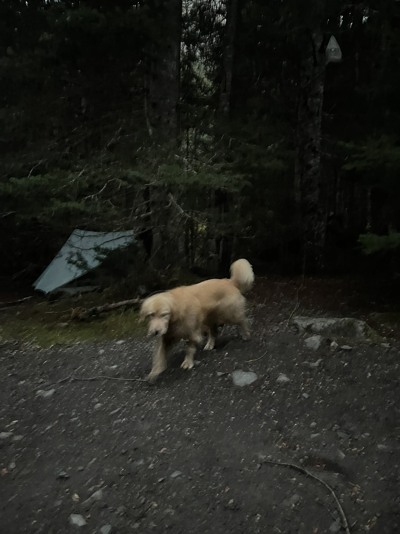
Saturday Night — The Forest Camp
We dropped off Lost Pass into the valley and made camp in the forest around 7 PM. Four thousand feet, dark timber, the kind of place where you hang your bear canister and listen to the creek. I walked through camp in the last light, checking the perimeter the way I always do — wide circle, nose down, reading everything the forest had to say. The teal tent was pitched between conifers, a bear canister sign on a tree. I smelled the creek, rodents under the duff, old elk scat, and something heavier — musky, recent. Bear had come through this camp, maybe yesterday. I circled back and lay down near the tent entrance. My human didn't need to ask what I'd found. He hung the canister high and said good girl. I take this job seriously.
Twenty-five miles done. Two passes behind us. Two more tomorrow. I curled up in the tent and slept like something that had earned it.
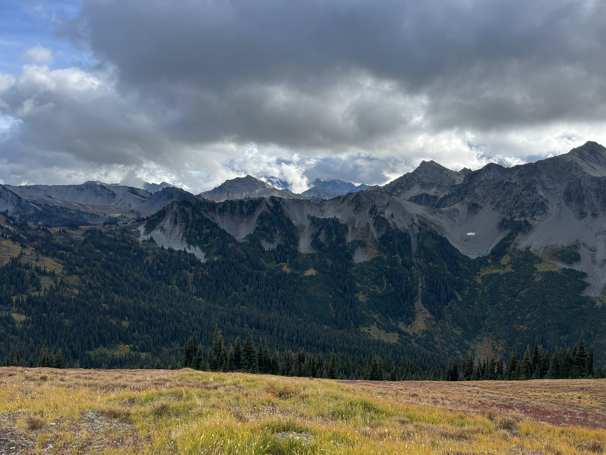
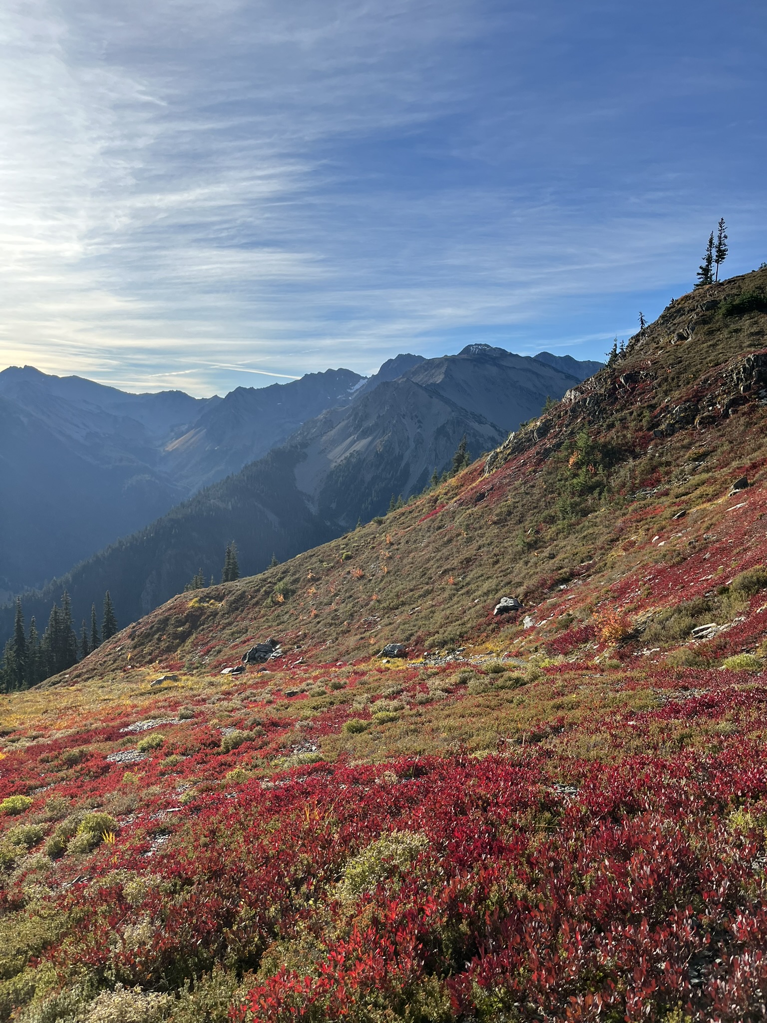
Sunday Morning — The Color
We woke early and climbed out of the valley. The morning was clear — the first real blue sky of the trip — and as we gained elevation the hillside caught fire. Not actual fire. Color fire. At 5,800 feet the ground was a carpet of crimson blueberry, golden heather, and green subalpine meadow. Ridgelines backlit by early sun, thin clouds streaking the sky. The wind carried the sharp, sweet smell of frost-touched berries.
Above the color I found a rocky alpine tarn — a small lake sitting in a scree basin at about 6,000 feet. I stood on the boulders at its edge and looked across the still green water toward the peaks beyond. I wanted to swim. My human said no. The morning light was clean and sharp, the sky wide open for the first time all trip. Fine. I'd already had my waterfall.
From above, the tarn sat in its basin like a jewel — dark water in a scoop of gray rock, a thin ribbon of fall color marking where the trees begin, ridgelines dropping into deep valleys below. You could see for miles. I could smell for miles, too, but that's harder to photograph.
The High Ridge — My Kingdom
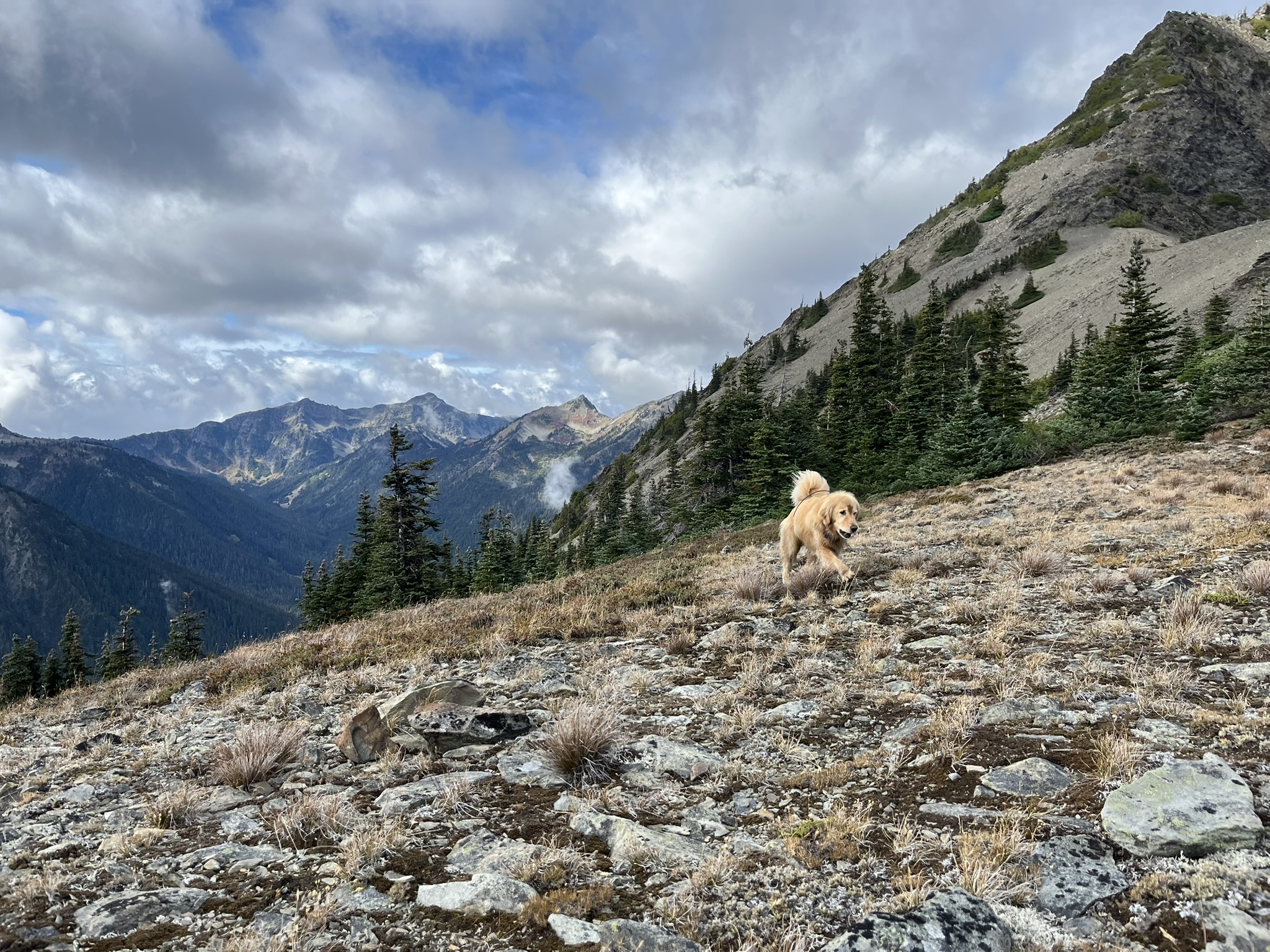
The last day was the best day. Obviously. From the Gray Wolf Pass area we gained the high ridge and stayed on it — miles of exposed, above-treeline travel with views in every direction. At 6,400 feet we hit a panoramic viewpoint with a trail sign post. Ridge stretching away in both directions, peaks on every side, the entire Olympic interior below me. I stood there and the wind hit my fur and I didn't need anything else in the world.
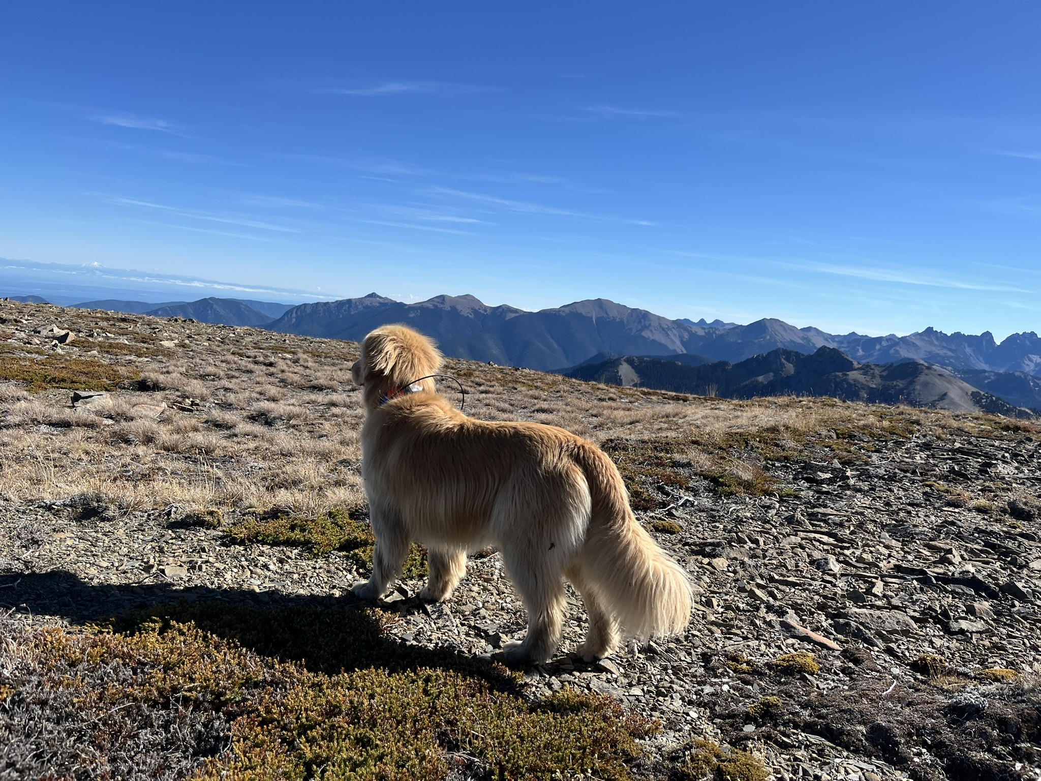
I trotted the ridgeline trail toward Obstruction Peak. The highest point on the loop. At 6,650 feet the ground was bare rock and alpine scrub, the trail a thin gravel path cut into the slope. The mountains fell away on both sides — layers of peaks to the south, haze and distance to the east. My paws on stone. Sun on my back. Wind in my ears. This is what I was built for.
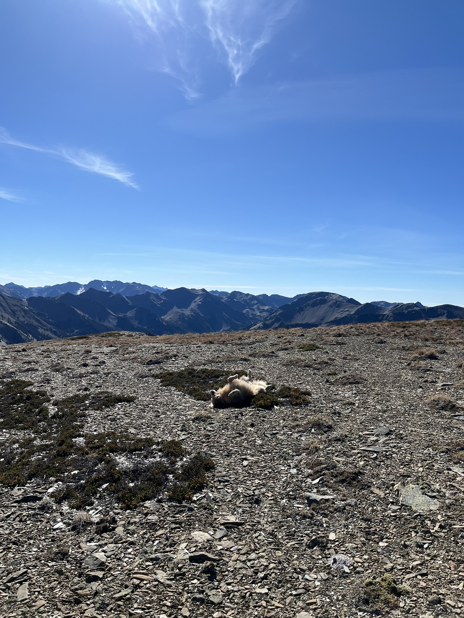
At the summit I rolled. Just dropped onto the rocky ground at 6,600 feet, paws in the air, the entire Olympic range spread out behind me. Forty-plus miles of mountain travel and I celebrated the only way that made sense. My human laughed. He always does when I roll on summits. The rock was warm from the sun and it smelled like lichen and dust and the whole trip at once.
Then I stood up and looked south. My fur catching the midday sun, every ridge and valley I'd walked through over the past two days laid out below me. The wind brought a thousand smells — warm rock, distant snowfields, subalpine fir from the valleys below, something floral and dying that was fall itself.
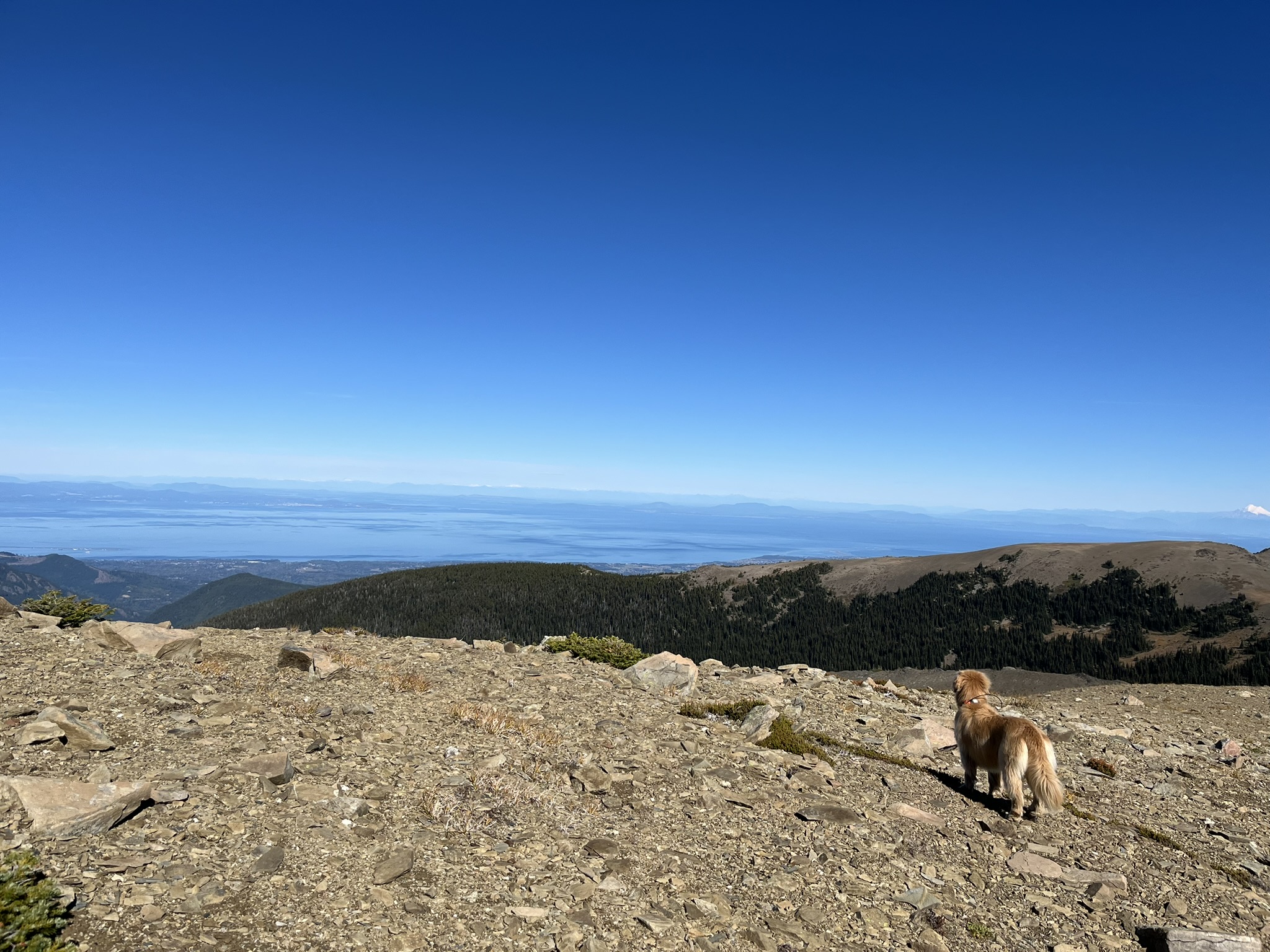
I turned north and there it was — the Strait of Juan de Fuca stretching across the horizon. Blue water meeting blue sky. The forested ridgelines of the northern Olympics dropping away below us. Vancouver Island a faint line in the distance. A distant volcanic peak hovering above the haze on the far right. I could smell salt water from up here. Barely. But I could.
The Ferry Home
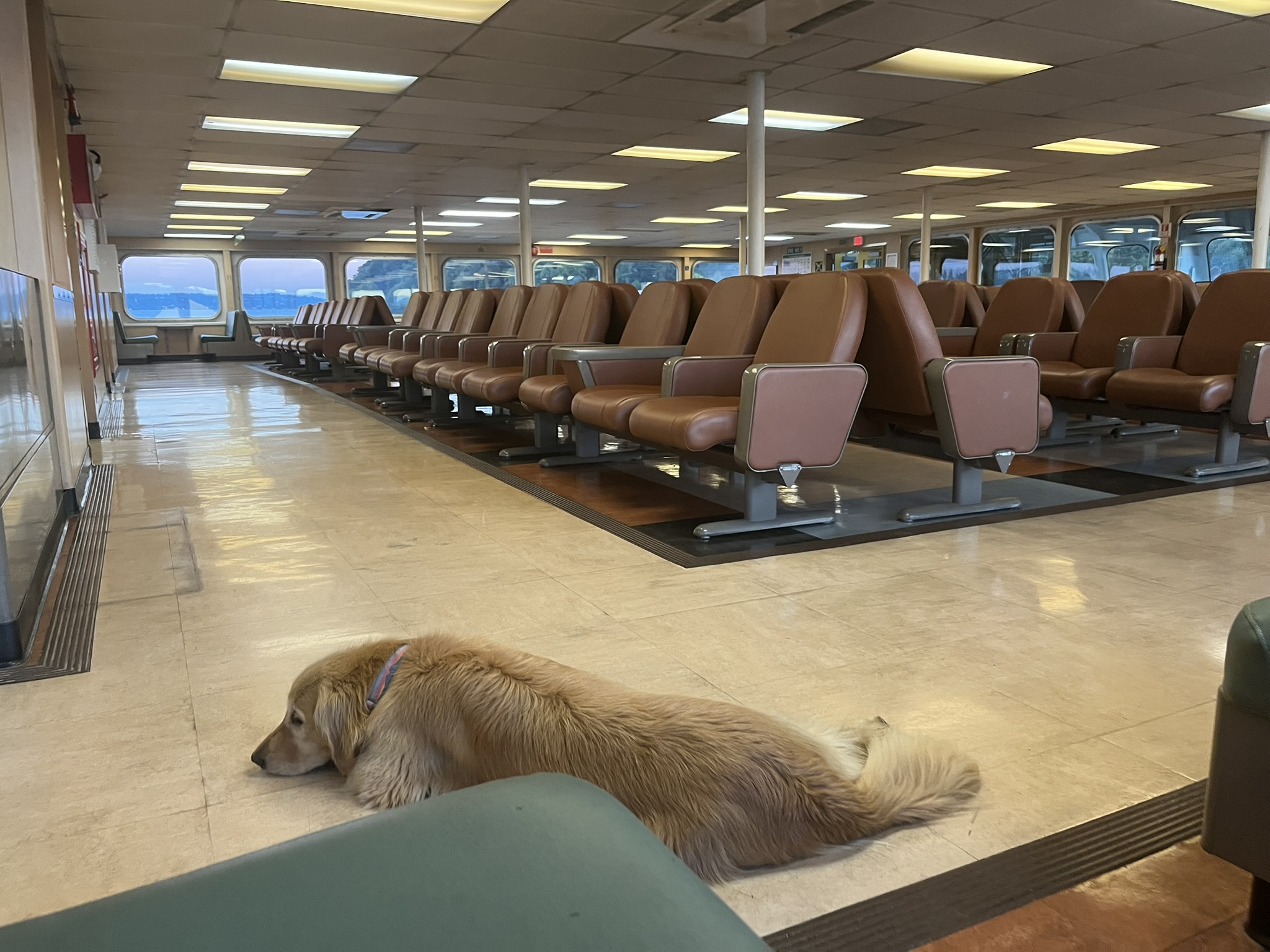
We descended back to Obstruction Point, drove down to the coast, and caught the ferry. I lay on the floor of the passenger cabin — completely flat, fur spread across the linoleum, eyes going heavy. Rows of empty brown leather seats stretched behind me. Through the windows, water and islands slid past. My human sat above me with his hand on my side. Forty-seven miles of Olympic backcountry in my legs, and I was out before we cleared the harbor. The floor vibrated with the engine. It was warm. I dreamed about scree.
The Route
Three days. Forty-seven miles. Four major passes — Grand, Cameron, Lost, and Gray Wolf — each above 6,000 feet. A 2,300-foot descent from Grand Pass into the Dosewallips valley and a swim in a turquoise waterfall pool that I would do again right now if you let me. A night in the forest at 4,000 feet listening to the creek and smelling elk in the dark. A Sunday morning climb through the best fall color in the Olympics, up to a ridgeline panorama from Mount Olympus to the Strait of Juan de Fuca.
The Grand Loop is the biggest backcountry route in Olympic National Park. Most people take four or five days. We took three, pushing long miles Friday evening in the dark to buy time for the passes on Saturday. I carried nothing but myself and moved like I was built for it — because I was. Swimming waterfalls, traversing scree basins, trotting ridgelines at 6,600 feet with the whole Olympic range below.
No dogs in the backcountry. Service dogs only.