The Long Walk In
Friday afternoon, late August. My human loaded the car and we drove the bumpy Middle Fork Road to Dingford Creek. Started walking around 5 PM with a few hours of light left. The plan — push deep along the Middle Fork Trail, camp high, then spend Day 2 in the granite country near La Bohn Gap. I approved this plan.
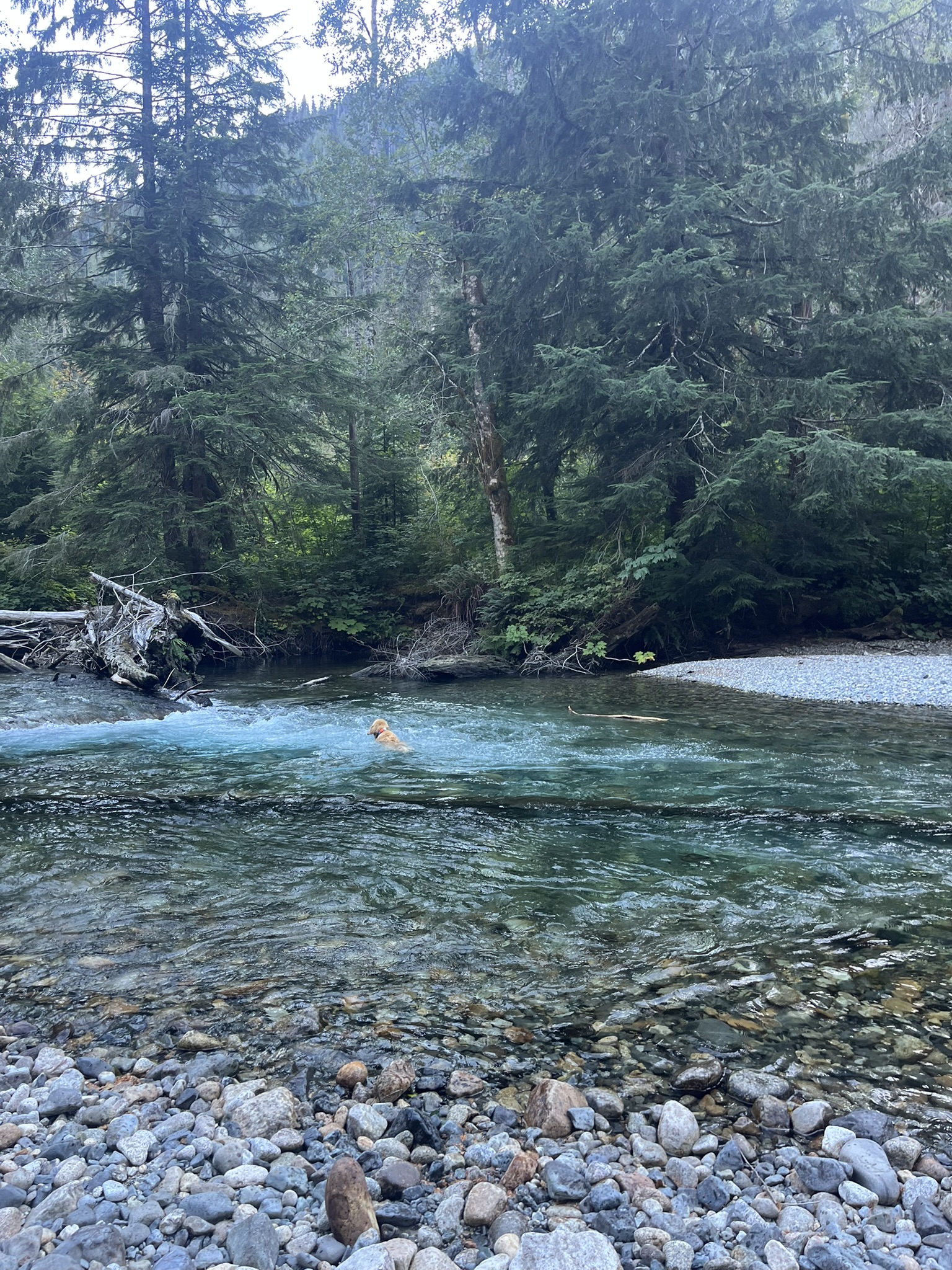
The Middle Fork Snoqualmie was running turquoise and cold and perfect. I was in it before we'd covered a mile. Couldn't help it. Old-growth forest pressing in from both sides, the air thick with cedar and wet stone and whatever had walked through here before us. That valley smells untouched. I caught deer musk and something sharper — maybe cat — on a log near the river. I stopped and held the scent for a long time, reading it. My human didn't notice until I froze. Then he looked where I looked. That's how it works between us.
Up Into the Boulders
Evening wore on and we left the river trail behind. I noticed the moment the ground changed — soft duff gave way to lichen-covered granite, boulders scattered across the slope. The peaks above caught the last orange light. Good scrambling. My kind of terrain.
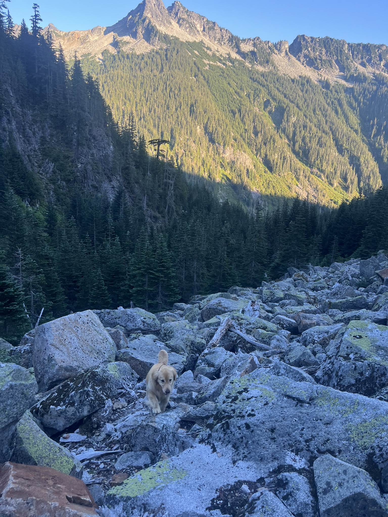
Higher still, we entered a granite valley so wide it swallowed sound. Steep walls on both sides, a pointed peak framed dead center. Rock, talus, patches of meadow. Everything smelled like cold stone and distant snowmelt. The scale of this place makes you feel exactly the right size — small, but strong enough to be here.
High Camp
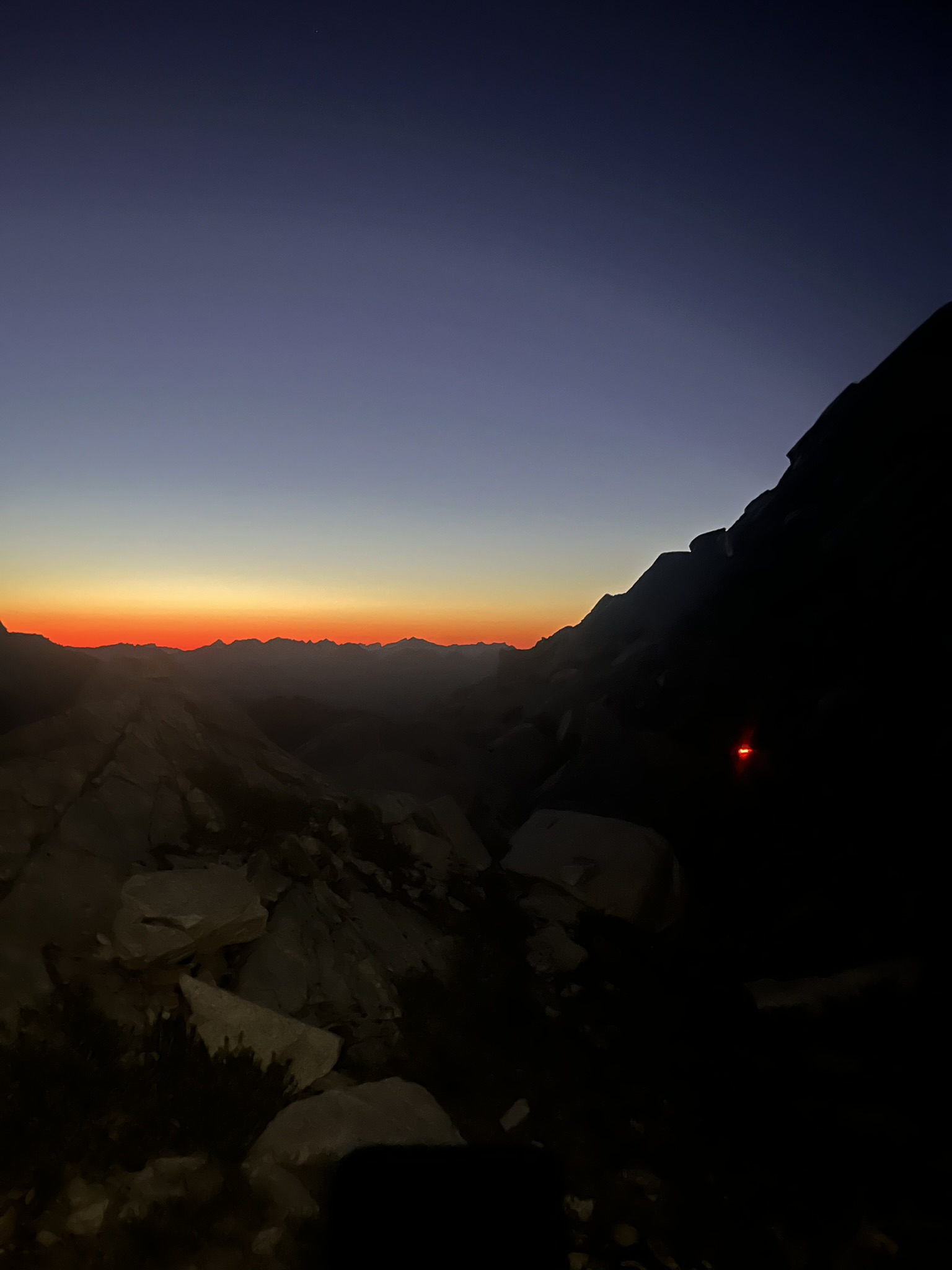
We pushed until dark. My human set up camp on granite at nearly 5,700 feet while I watched the sky do something extraordinary — a vivid orange band stretched across the horizon, silhouetted peaks in every direction, the whole Alpine Lakes Wilderness spread below us like a map. The rock still held a trace of the day's warmth under my belly. The air at altitude had that sharp cold edge that makes every breath feel clean.
Day Two — Williams Lake
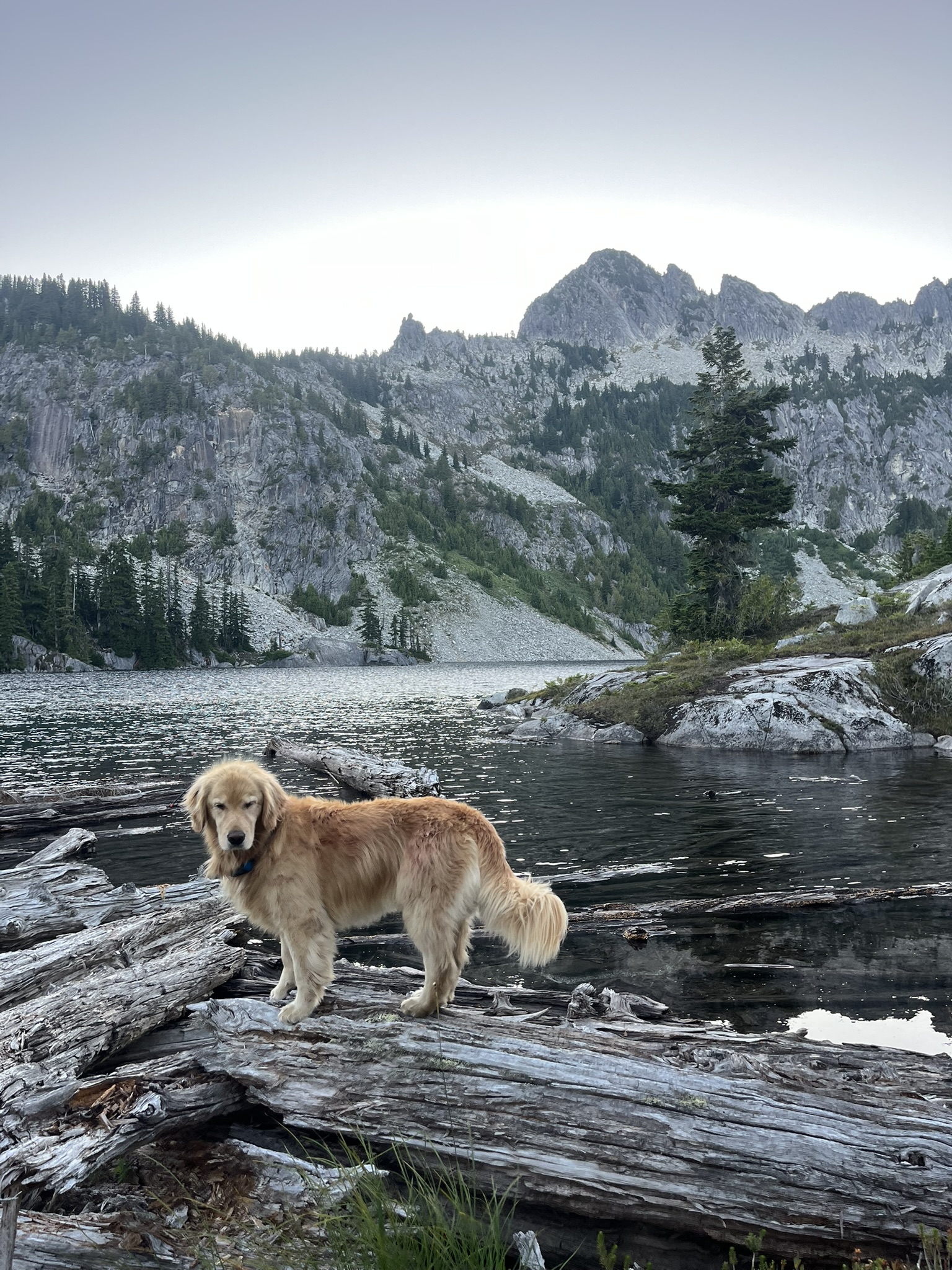
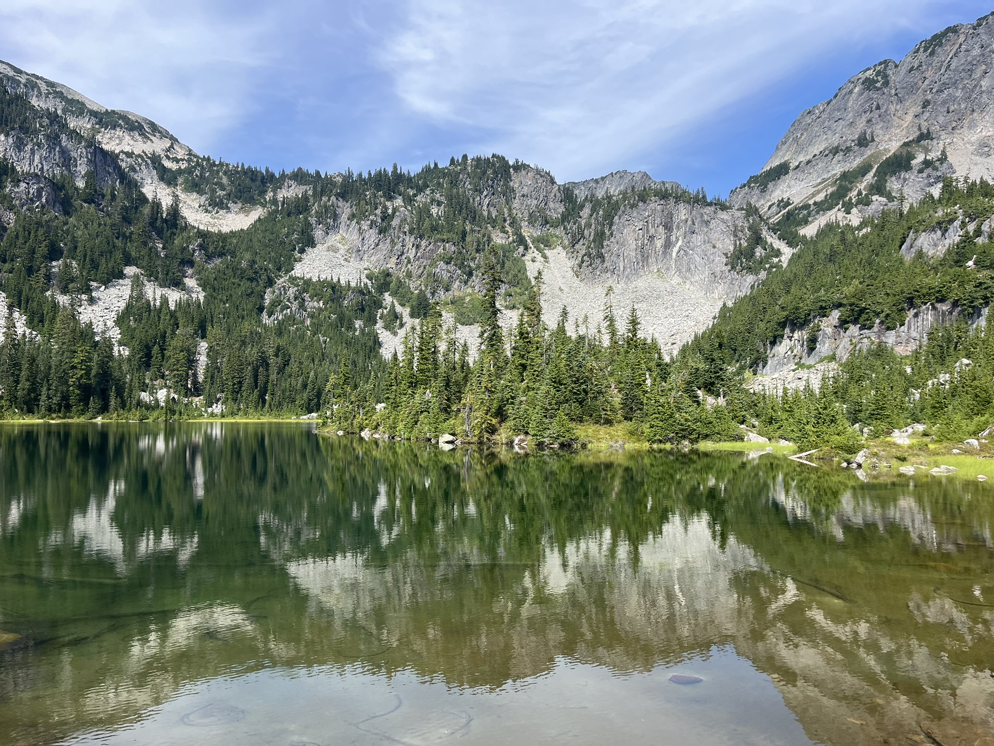
I woke to cold and clear and the smell of frost on granite. We descended through subalpine meadows to Williams Lake — a big alpine lake around 4,800 feet, tucked below a jagged ridgeline. I stood on the weathered logs at the shore and took inventory. The water was still. The granite was sharp. Everything was where it should be.
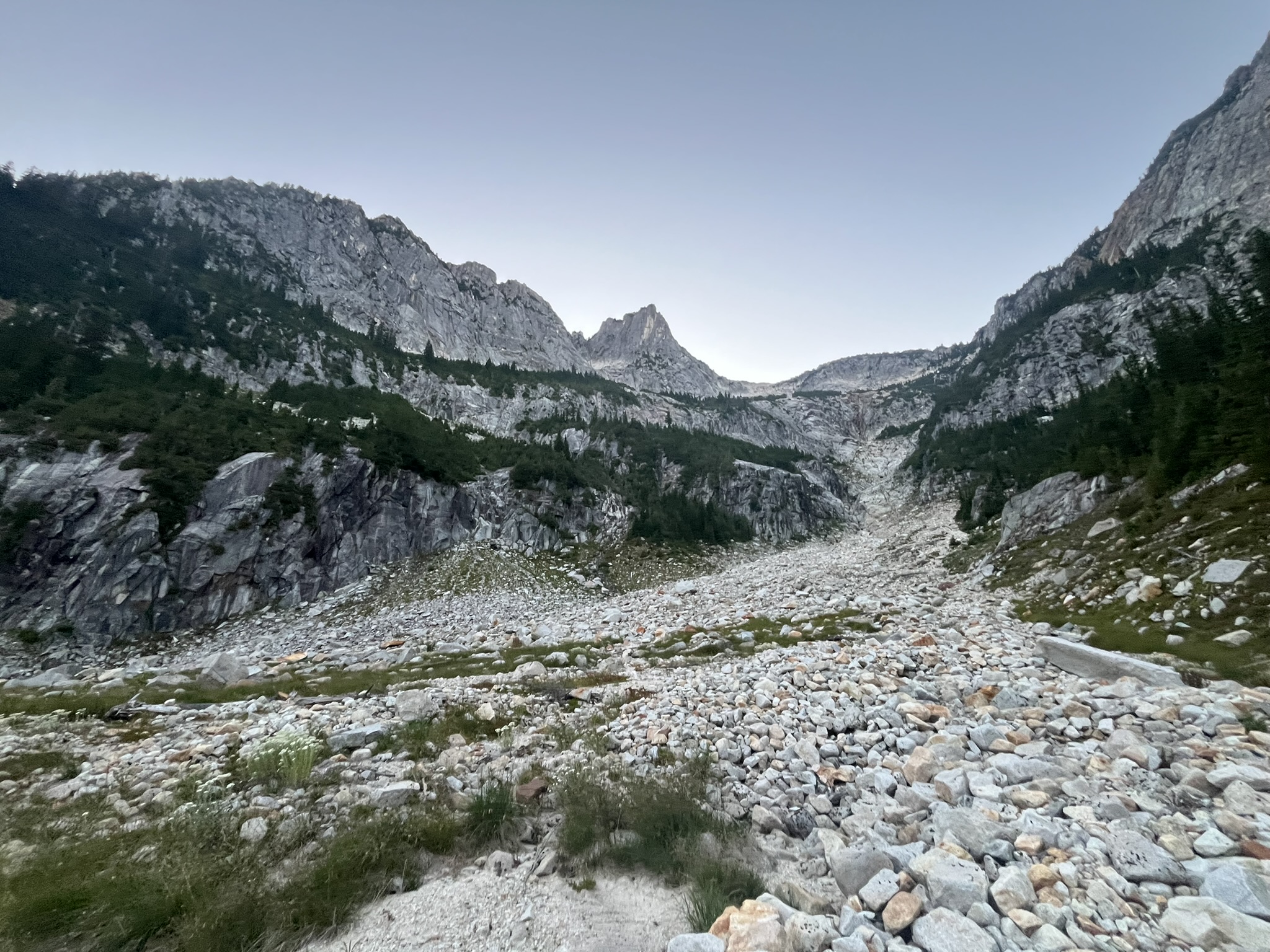
Into the Granite
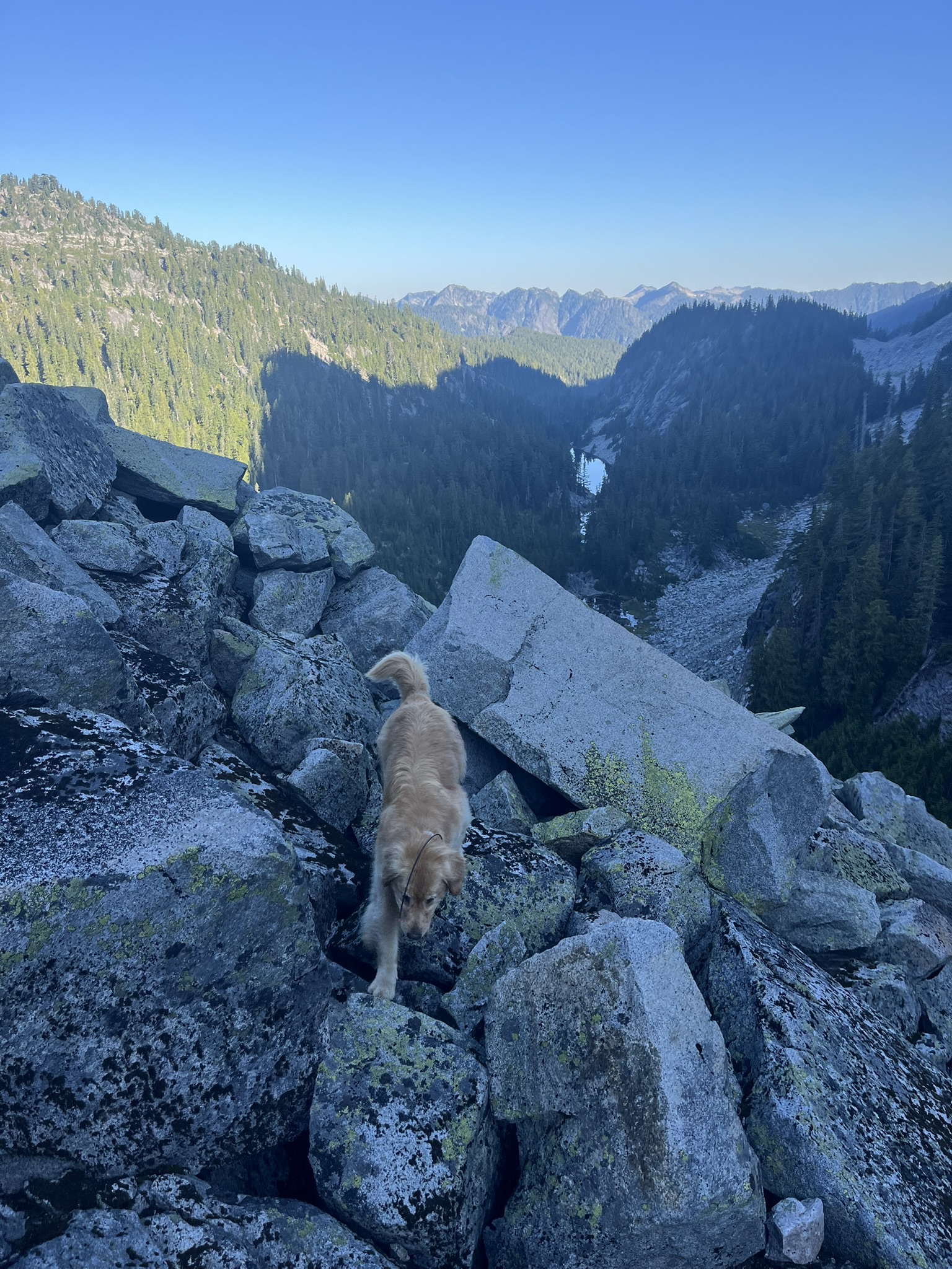
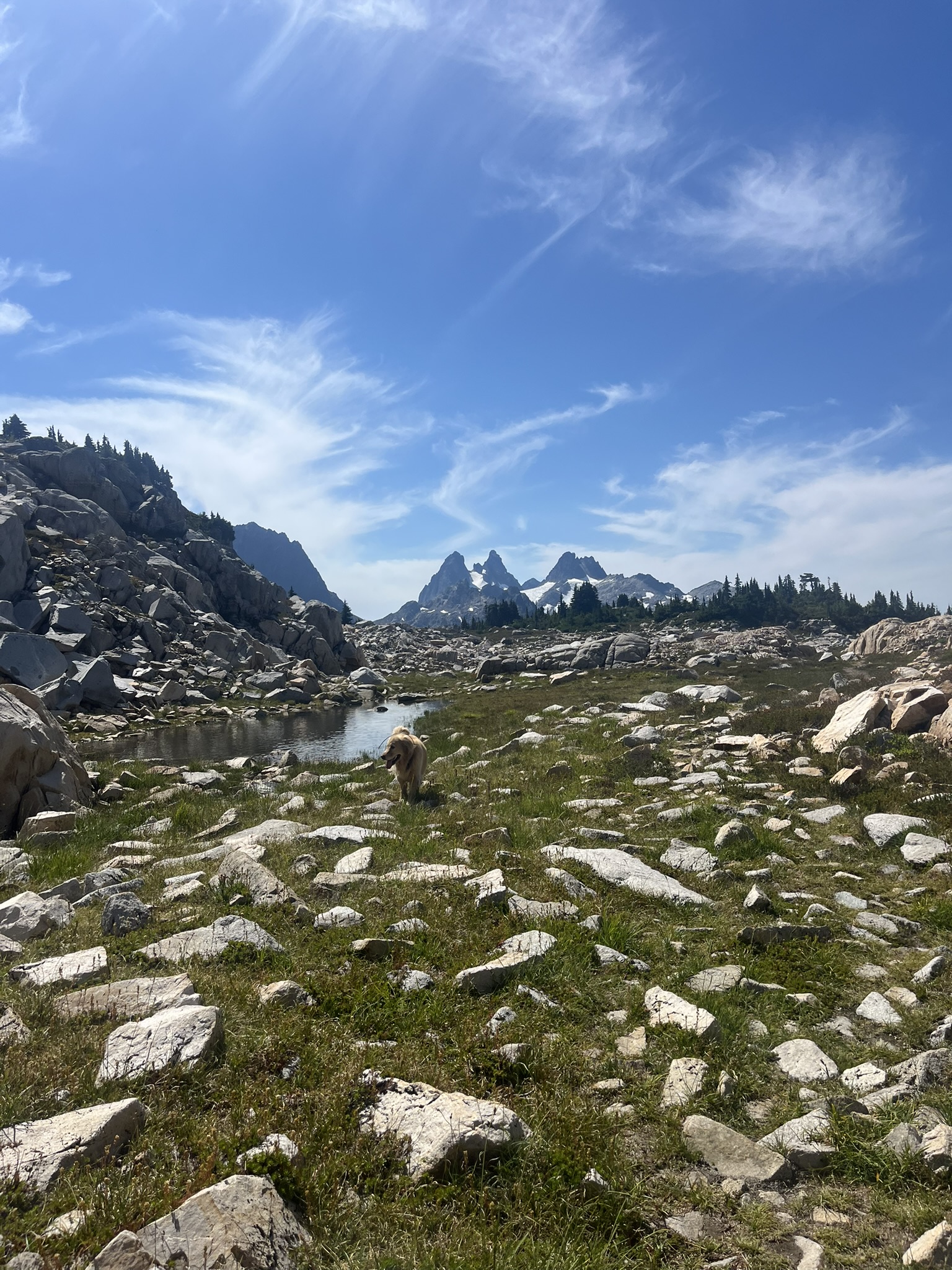
Above Williams Lake, the route left any pretense of trail behind. Boulder fields, ridgelines, views straight down to lakes hundreds of feet below. This is where I do my best work — picking lines through granite, nose reading the wind for what's ahead, paws finding the right holds. My human follows. Usually.
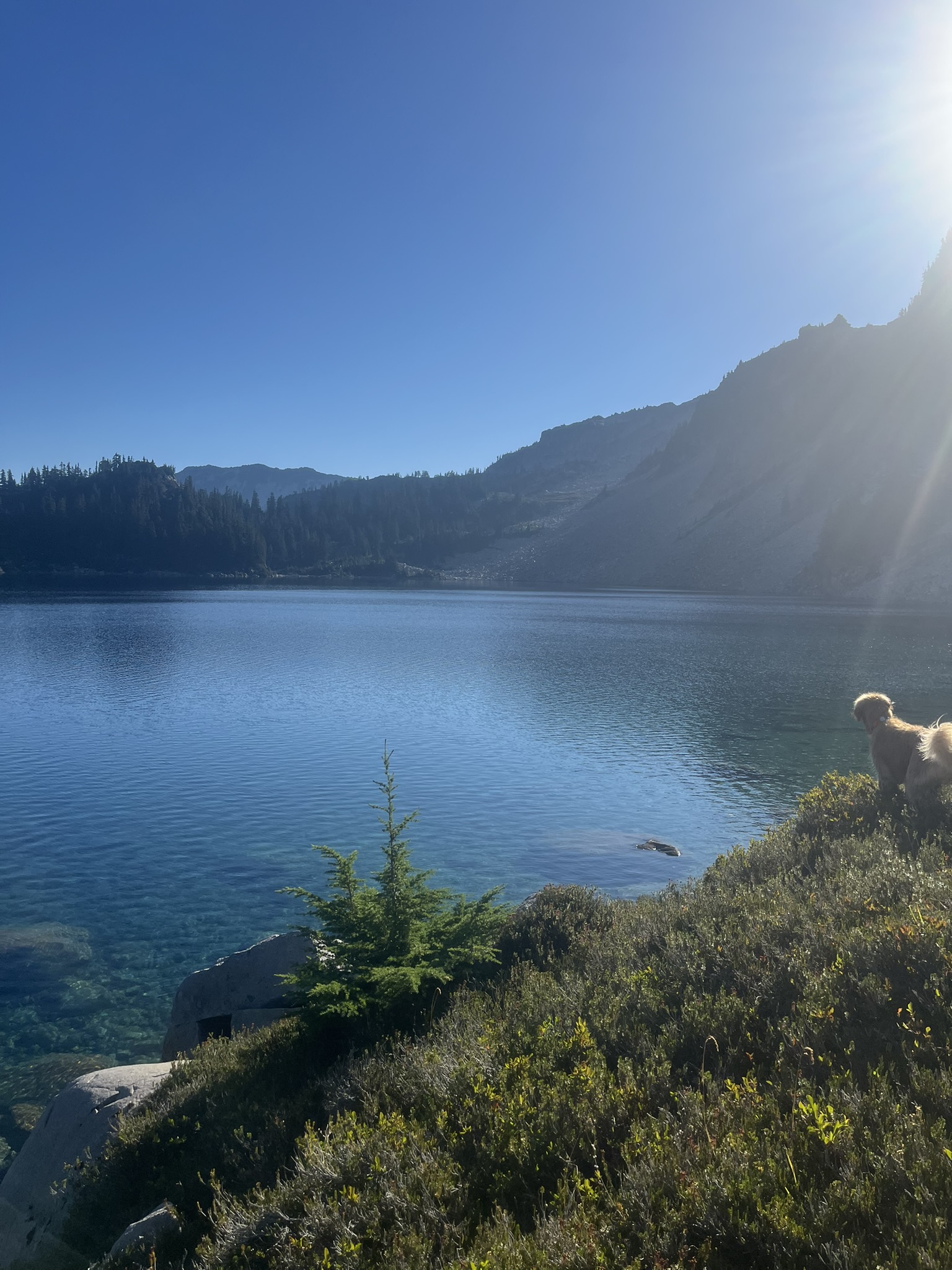
We dropped to a large lake — deep blue, backed by a steep rock wall, sun streaming across the surface. I found the shore and waded in to my chest. The water was so cold it made my teeth ache. Obviously I stayed in.
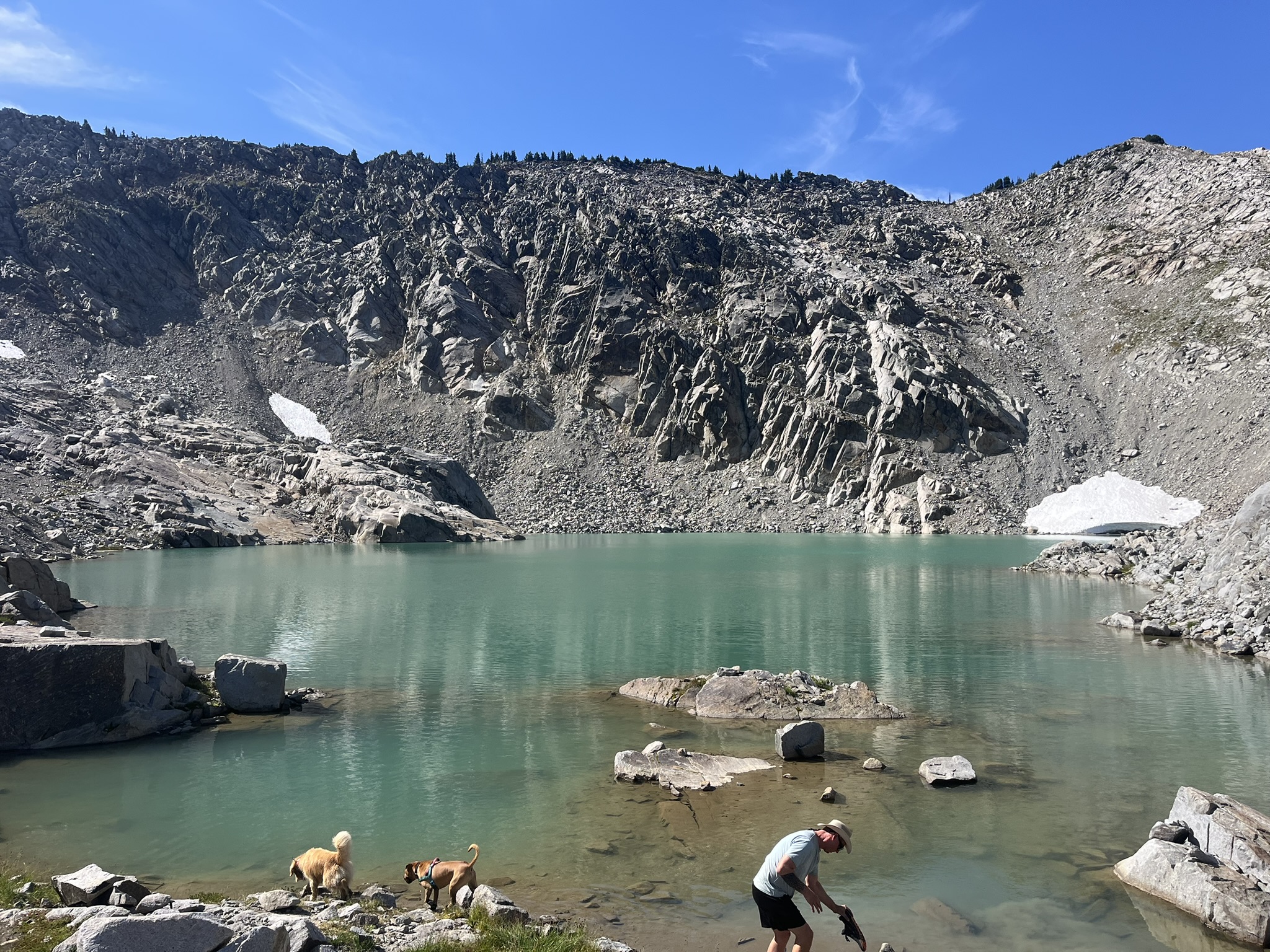
Iron Cap Lake
Iron Cap Lake. This is the one. A turquoise tarn cupped in a steep granite cirque, snow patches still clinging to the walls in late August. The color of that water is not a real color. It's the kind of blue-green that makes you forget you have legs until you're already swimming.
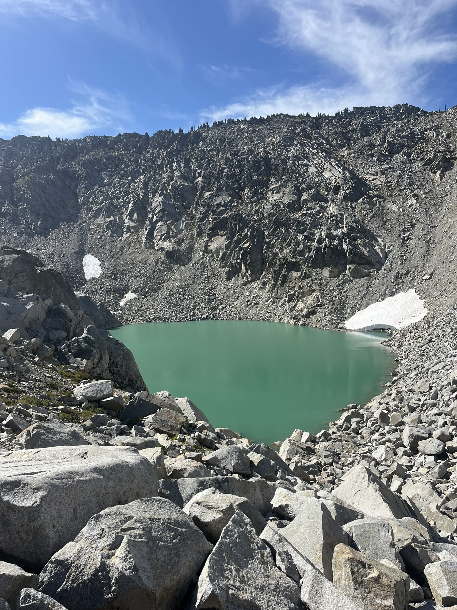
I waded in while some hikers and another dog splashed around nearby. The other dog wanted to play. I ignored it — I was here for the water, not the social scene. Crystal-clear glacial water at 5,500 feet, granite walls rising on every side. Cold enough to make my fur stand up. I stayed in anyway. The water tasted like snowmelt and minerals and the inside of a mountain.
The High Route
Beyond Iron Cap, the terrain opened into something that felt like the top of the world — granite slabs, alpine meadow, a faint boot path threading between jagged peaks. I trotted ahead toward a dramatic spire rising above the basin. The wind up here carried the smell of heather and warm rock and absolutely nothing human. Just the faint musk of marmot colonies in the talus and the dry scent of something with hooves that had passed through the basin earlier. I noted it all and kept moving. Not my territory — I was just passing through theirs.
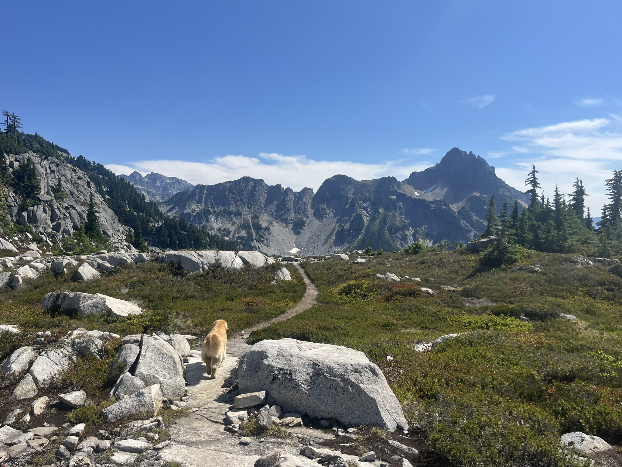
This is the heart of the Alpine Lakes. I know this because everything in my body said so — the air, the light, the way the granite stretched in every direction with heather between the cracks and sky filling the rest. A flat alpine bench between outcrops. Jagged spires across the horizon. I was a gold dot in all of it, and that was exactly right.
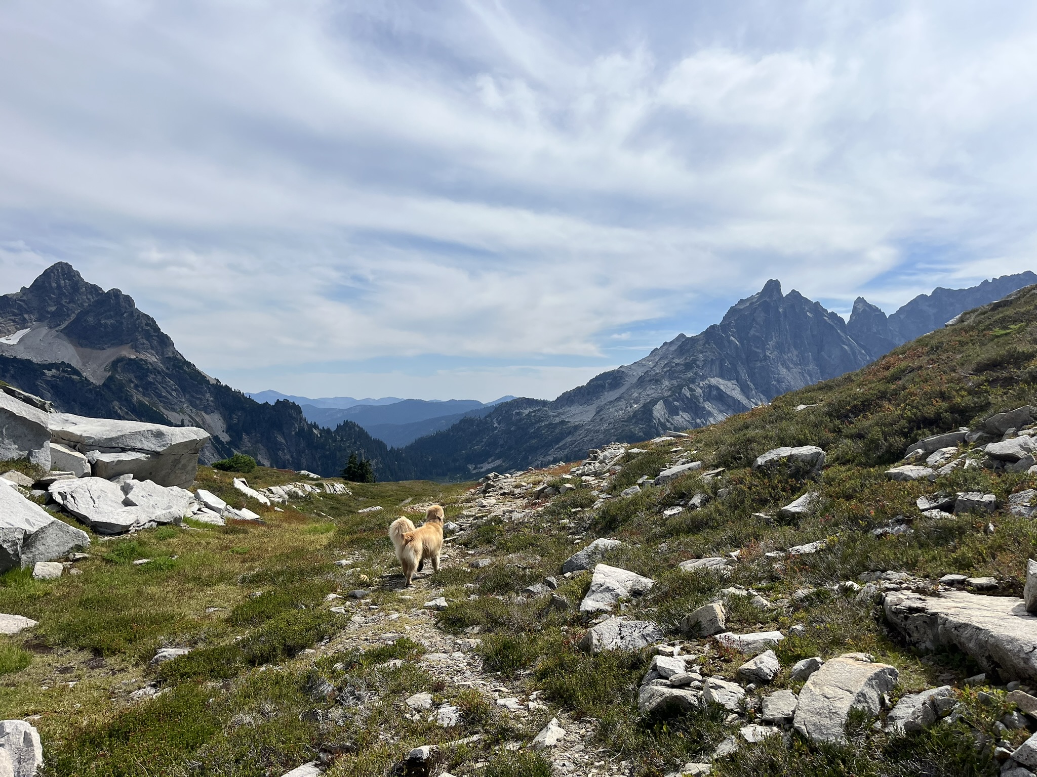
The High Point
We reached 5,800 feet — the divide between the Iron Cap basin and everything beyond. I stood in the alpine heather with massive peaks flanking both sides and a deep valley falling away between them. Wind on my fur. The whole Cascades below. I could smell rain somewhere far to the west but here it was nothing but sun and stone.
Heading Home
The route back dropped us past Williams Lake again. From above, the lake was mirror-still — reflecting every tree and ridge so perfectly it was hard to tell which world was real. Probably both.
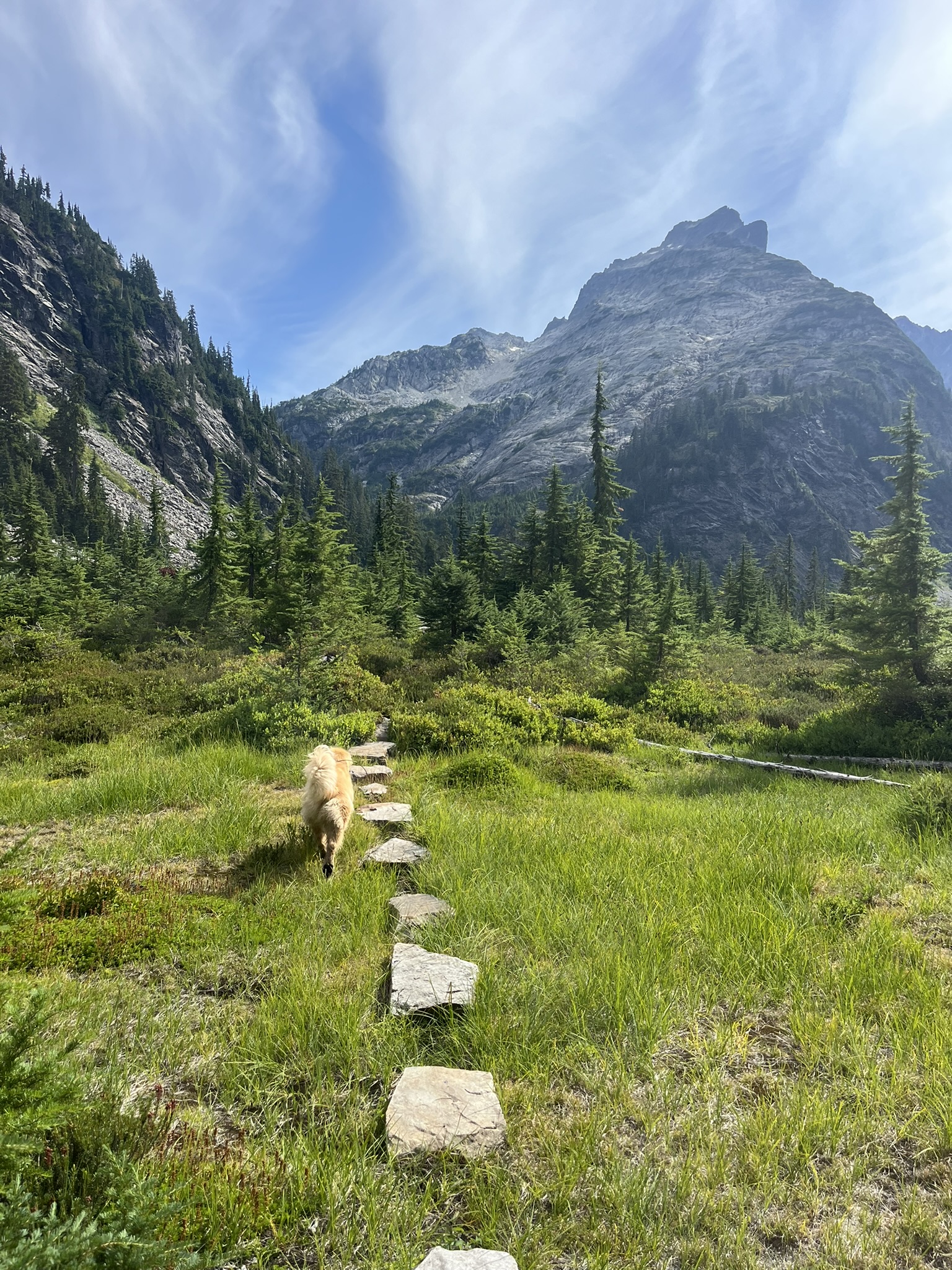
I led the way across stepping stones through a lush green meadow, a rugged peak rising ahead, the subalpine stretching around us. My paws knew exactly where to land. They always do.
The Route
Two days. Nearly 39 miles. 8,500 feet of gain. A long flat approach along the Middle Fork Snoqualmie, then straight up into granite basins, turquoise tarns, and the wide-open high country near La Bohn Gap. Most of it off-trail. Most of it mine.
This is one of the great traverses in the Alpine Lakes Wilderness — the kind of route where you don't see another person for hours and every turn reveals another basin, another lake, another wall of granite. I handled the boulder fields, the route-finding, and the long miles the way I handle everything. Professionally. My human drove us home with the windows cracked. I was asleep in the car before we hit the highway.